Shift Towns · Massachusetts
Walking, biking & transit in Revere
See the routes Revere neighbors actually walk, ride and take transit on, what's happening locally, and how the town is trending — built from real trips logged in the Shift app.
Keep a pulse on Revere. New street projects, meetings worth your voice, and how Revere is moving. One or two emails a month.
Get involved in Revere
Safer streets are made by neighbors who speak up. Start small:
Revere - Walk, Bike, & Roll Advisory Committee seeking new members
The City of Revere is recruiting members for its Walk, Bike, & Roll Advisory Committee — a citizens' advisory board that helps steer, guide, and advocate for safe, accessible infrastructure for walking, biking, and rolling throughout the city, in partnership with the Metropolitan Area Planning Council (MAPC). The membership application takes a few minutes and asks about how you get around Revere — no special experience needed.
Apply to join the committee→- Report a street problemRevere 311→
- Read the walking and biking planWalk Bike Roll Revere (Planning and Community Development)→
- Apply to joinWalk, Bike, & Roll Advisory Committee→
In Revere
Your transportation department
- Revere Department of Public Works — The city department that maintains and repairs Revere's streets, sidewalks, drainage, and street sweeping.
Regional & statewide groups, 7 more
Advocacy groups
- LivableStreets Allianceregional — The Metro Boston advocacy group for people-centered streets and transit, whose research and comment letters cover projects across the region.
- TransitMattersstatewide — The transit advocacy group pushing for faster, more reliable buses and trains across Greater Boston, with data-driven campaigns anyone can join.
- Transportation for Massachusetts (T4MA)statewide — A statewide coalition of community groups advocating for safe, affordable, and reliable transportation choices in every corner of the state.
- WalkMassachusettsstatewide — The statewide walking advocacy organization that leads walk audits and pedestrian-safety campaigns, with open network meetings on Zoom the third Wednesday of each month.
- MassBikestatewide — The statewide bicycling coalition — a way to plug into bike advocacy, group rides, and Bike Month events across Greater Boston and beyond.
Commuter perks & fare help
- MBTA reduced faresstatewide — Reduced-fare programs for seniors, riders with disabilities, people aged 18–25 on low incomes, and middle and high school students. Most cut the fare roughly in half.
Get updates
- MBTA accessibility alertsstatewide — Live notices when an elevator or escalator is out of service, plus how to arrange a shuttle when one is. Worth subscribing to if a lift is part of how you get to the platform.
Events near Revere
A few picks over the next 30 days — the full calendar has everything.
Somerville Cycle & Social: Ride to Sam Adams Downtown
Tue, Nov 10 · Somerville Community Path behind Republic Fitness, Davis Square · 6.8 mi away
Beginner-friendlyFreeElm-Beacon Connector Mini-Ride
Sat, Nov 14 · Lou Ann David Park · 7 mi away
FreeFamily-friendlySomerville Cycle & Social: Final Weekly Ride, Esplanade Loop and Aeronaut
Tue, Nov 17 · Somerville Community Path behind Republic Fitness, Davis Square · 6.8 mi away
Beginner-friendlyFreeExplore the North Reservoir Shores of the Fells (Hike for Adults 50+)
Sun, Nov 8 · N Border Rd Fells Trailhead · 7.2 mi away
Older adultsBeginner-friendlyTuesday Morning Walk for Women Over 40
Tuesdays · next Tue, Nov 10 · 351 Boylston St, cnr with Arlington Street, Boston, MA · 6.1 mi away
FreeWomen and nonbinaryBeginner-friendlyRoams to try
Self-guided routes. Preview the full route here, then check in at each stop in the Shift app to unlock the badge.
 Photo by Brett Wharton on Unsplash
Starts 4.2 mi from central Revere · Walk + transit · 1.7 mi route · 1 hr · East Boston
Boston's best-kept-secret Harborwalk + Latin American food scene.
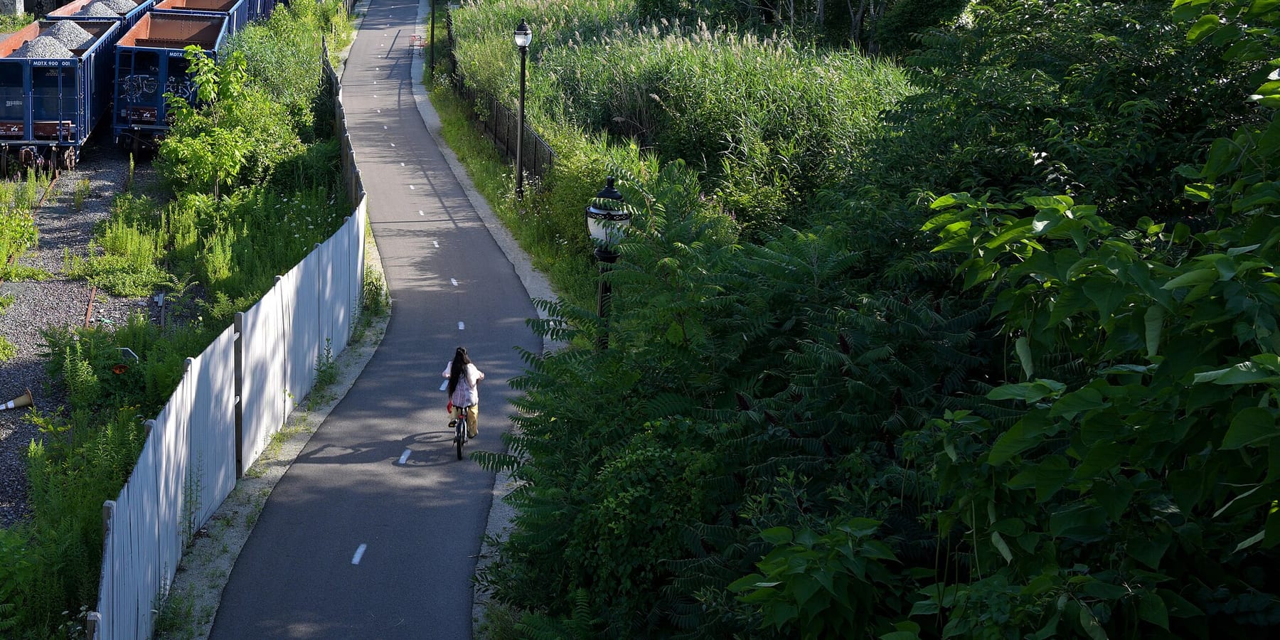
Starts 4.4 mi from central Revere · Bike · 9.3 mi route · 1 hr · Everett · Lynn
A paved rail trail from the Mystic River to Lynn, straight across the Rumney Marsh
 Photo by Charlie Hales on Unsplash
Starts 5 mi from central Revere · Walk + transit · 13.6 mi route · 7 hr · Boston Harbor
A national park 20 minutes from Long Wharf by ferry.
Trails in and near Revere
Paths of their own for walking and biking, with where to get on.
- 6
- active trips so far in November
- 25
- active miles
- 22
- lbs CO₂ avoided*
- 2
- neighbors active so far in November
Revere joins the Massachusetts board once it logs 20+ trips in a month. Shift Rate is the share of trips taken actively (walk, micromobility, transit). Counts cover November 1 through today, based on trips logged by Shift community members that start or end in Revere — a growing sample, meant as an interesting local signal, not an official or census-level count. *CO₂ avoided is estimated from active miles traveled (EPA 404 g/mi baseline).
Momentum
Active trips in Revere by week ending, last 5 completed weeks.
Friendly competition
Massachusetts towns by shift rate so far in November, the share of trips taken actively. Every town here has its own page: local stats, popular routes, events, and ways to get involved.
How Revere moves
Trips and miles neighbors logged so far in November, by mode.
Share of trips
Share of miles
- Biking & scooting
- 2 trips · 5.3 mi
- Bus
- 1 trips · 6.6 mi
- Train
- 3 trips · 13.1 mi
- Driving
- 3 trips · 16.7 mi
What is this?
Shift is a free app from Green Streets Initiative, a Somerville nonprofit since 2006, for finding better ways to get around. Every walk, bike ride and transit trip people take with Shift adds to Revere's totals on this page. Shift counts trips on its own.
Put Revere on the board.
Every walk, ride, and transit trip counts automatically. Download Shift free and put your trips on Revere's board.


Community stats reflect trips by Shift community members that start or end in Revere and refresh hourly. Municipalities and community groups can request aggregate data at info@gogreenstreets.org. A project of Green Streets Initiative, a 501(c)(3) nonprofit.