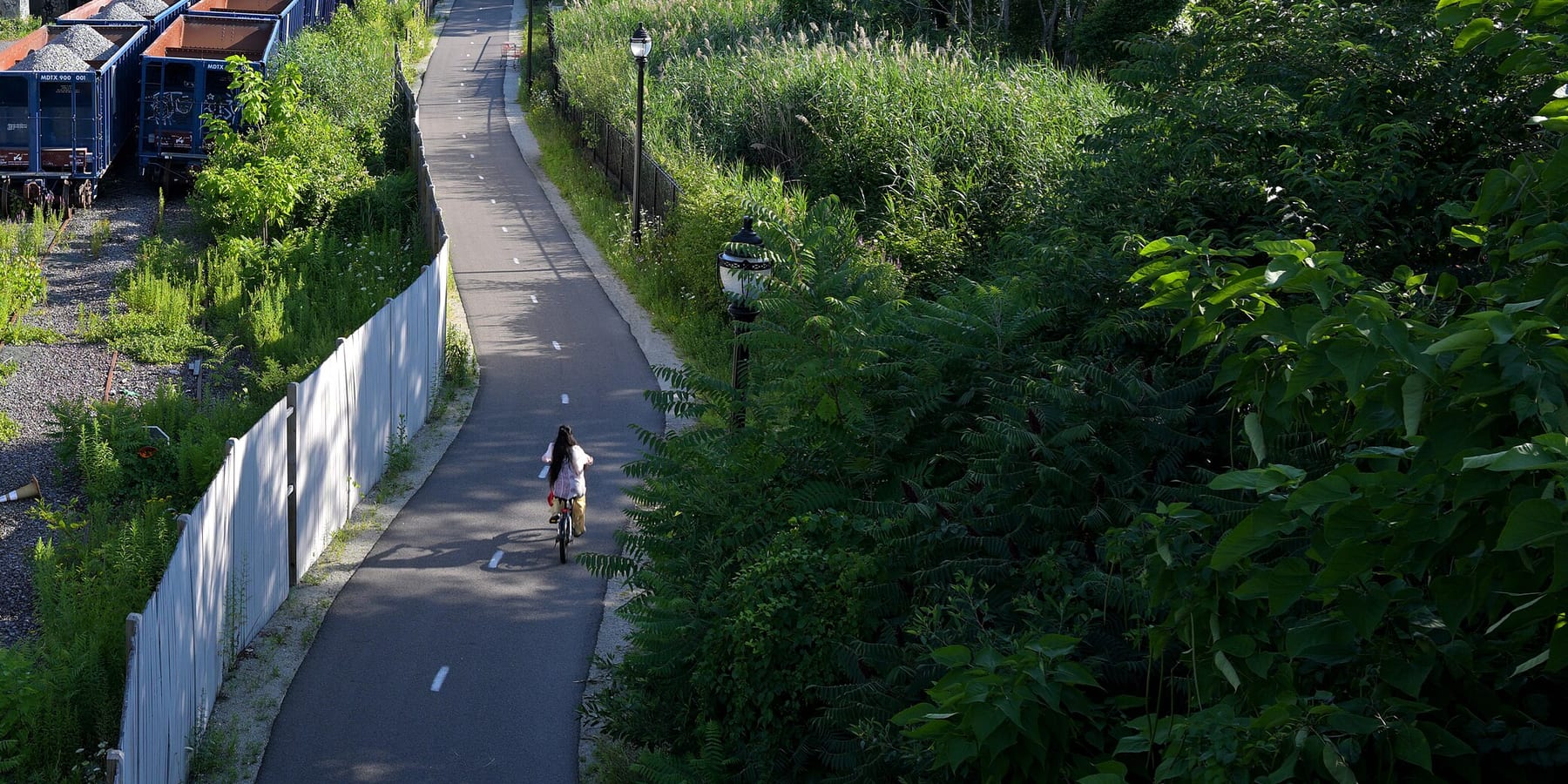
Northern Strand Trail
The Northern Strand is a paved path on an old rail line that runs about 10 miles from Everett through Malden, Revere and Saugus to West Lynn. People use it to get to work and school, to ride with kids away from traffic, and to reach the North Shore by bike.
- Length
- 9.9 mi
- rail trail
- Surface
- Paved
- the whole way
- Get on at
- 8 places
- on the map
From Gateway Center / Encore Riverwalk connector to Western Avenue
Parking at 1 of the 8 places to get on · See where
Train back from Lynn station · Next trains
Partly plowed in winter · Who clears it
Where to get on
Numbers match the list; P has parking.
Download the GPXFor Ride with GPS, Strava, Komoot or a bike computer.
Gateway Center / Encore Riverwalk connector, Everett
Southern end of the trail, behind Gateway Center. A Bluebikes station (Encore) is about 270 m away.
- MBTA bus 97 and 99 at Gateway Center @ Target (about 300 m)
West Street and Wellington Avenue, Everett
Bluebikes station 'Northern Strand - West St & Wellington Ave' is right on the trail.
DirectionsBike to the Sea Bike Kitchen, Canal Street, Malden
Bike to the Sea's Bike Kitchen (158 Canal St) is on the trail. Bluebikes station 'Northern Strand at Bike Kitchen' is here.
- Malden Center (Orange Line and Haverhill Line) is about a third of a mile northeast. MBTA bus 97 on Medford St (about 300 m).
Centre Street (Route 60) by Malden High School, Malden
Bluebikes station 'Malden High School' is about 40 m away.
- MBTA bus 105 on Eastern Ave, buses 106, 108, 411 and 430 on Salem St, bus 104 on Ferry St (all within about 250 m)
- Bike to the Sea's map points to the hockey rink lot on Route 60 across from Malden High.
Linden Square, Lynn Street and Wesley Street (Malden/Revere line)
Where the trail passes from Malden into Revere.
- Linden Square bus stops: MBTA routes 108, 109, 119, 411, 426, 428, 429
Salem Street, Revere (near the Saugus line)
Bluebikes station 'Northern Strand at Salem Street' is on the trail.
- MBTA bus 426, 428, 429 at Salem St opp Franklin
Essex Street, Cliftondale, Saugus
Saugus section, near Cliftondale Square.
- MBTA bus 429, 430 at Essex St opp School St
Western Avenue (Route 107), West Lynn
Current end of the open trail. The new extension through downtown Lynn to Nahant Beach starts here and is still under construction.
- MBTA buses 424, 426, 436, 441, 442, 450, 455 at 743 and 760 Western Ave
Getting there
- By transit
- Malden Center (Orange Line and Haverhill Line commuter rail) is about a third of a mile from the trail near the Bike Kitchen.
MoreLess
Many MBTA bus routes cross the trail, with the most at Linden Square and on Western Avenue in Lynn. Lynn's commuter rail station is being rebuilt, and Newburyport/Rockport Line trains now stop at Lynn Interim (11 Ellis St), about 1.4 miles past the trail's Western Avenue end.
- Bike share
Near Gateway Center / Encore Riverwalk connector, right now
- Encore3 min walk · 2 bikes
- Broadway at Lynde St6 min walk · 6 bikes
- Parking
- Bike to the Sea says there are many informal access points with free parking along the trail, and its trail map shows suggested spots.
MoreLess
The one it names is the hockey rink lot on Route 60 across from Malden High School.
Ride out, train home
Ride the trail one way and take the Commuter Rail back. Lynn station is 1.4 miles from the trail's end at Western Avenue.
A roam on this trail
A roam is a self-guided route with stops along the way. The free Shift app checks you in at each stop, and you unlock a badge at the end.
The whole trail
Northern Strand Trail
A paved rail trail from the Mystic River to Lynn, straight across the Rumney Marsh
9.3 mi 1 hrIn the Shift app
Get Shift, free. Follow a roam with turn-by-turn directions to each stop, and see closures on your trails before you go.


Keep going
The Northern Strand Trail joins other paths and protected bike lanes. Pick a direction to see it on the map.
This trail Where you can keep going Other bike paths
About the Northern Strand Trail
- Surface
- Paved (asphalt) the whole way from Everett to Western Avenue in Lynn.
- Rules
- Motor vehicles are not allowed.
- In winter
- Malden plows its 3 miles when it plows the streets, but not for an inch of snow, and does not salt. Other towns may not. Source
- Conditions on every path
- Water
- Bike to the Sea says there are water fountains along the trail, but does not list where.
- Who looks after it
- Owned and run by the cities and towns it passes through (Everett, Malden, Revere, Saugus, Lynn) on former rail land leased from the MBTA. Bike to the Sea, a nonprofit, planned it with the cities and still looks after it. MassDOT is building the Lynn extension.
- Also called
- Northern Strand Trail, Northern Strand, Bike to the Sea Trail, Saugus Branch rail trail, Border to Boston Trail (southern section)
Notices
Work and changes along the trail, with the way around where there is one.
Lynn extension not open yet. MassDOT is building a two-way protected bike path (about 1.9 miles) on Market Square, South Common St, Market St, the Lynnway and Nahant Road, with lane, sidewalk and parking changes in downtown Lynn.
From the trail's end at Western Avenue in Lynn through downtown Lynn to Nahant Beach
MassDOT plans to finish by Nov 15, 2026. No official detour. Riders going past Western Avenue use city streets through active construction.
Source
More about the trail
- Friends of the trail · biketothesea.org
Where these facts come fromChecked Oct 19, 2026
- biketothesea.org
- biketothesea.org/faqs
- biketothesea.org/map
- biketothesea.org/detours-and-alternative-rides
- traillink.com/trail/northern-strand-community-trail
- en.wikipedia.org/wiki/Northern_Strand_Community_Trail
- masstrailtracker.com/map
- citizenportal.ai/articles/8330078/Massachusetts/Essex-County/Lynn-City/MassDOT-outlines-timeline-for-Northern-Strand-bikelane-project-in-Lynn-councilors-press-safety-business-and-access-concerns
- mass.streetsblog.org/2025/12/23/new-trails-to-look-forward-to-in-2026
- mass.streetsblog.org/2025/06/16/eyes-on-the-street-the-northern-strand-gets-a-protected-path-through-downtown-lynn
- mass.streetsblog.org/2024/07/16/massdot-officially-breaks-ground-on-northern-strand-extension-through-downtown-lynn
- itemlive.com/2026/07/07/market-street-project-makes-lanes-sidewalks-and-parking-scarce
- gbfs.bluebikes.com/gbfs/en/station_information.json
- api-v3.mbta.com/stops
- https://www.openstreetmap.org (Overpass API, Northern Strand ways)