Twin Cities Rail Trail
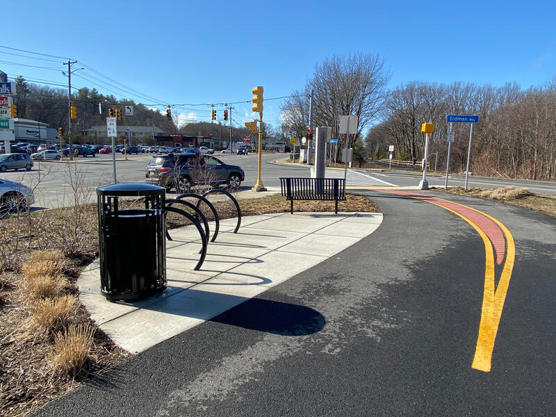
The Twin Cities Rail Trail is a paved path on an old rail line that links downtown Fitchburg and downtown Leominster. It runs along the North Nashua River and over a bridge across Route 2, so people use it for trips between the two cities and for easy rides and walks.
- Length
- 4.1 mi
- rail trail
- Surface
- Paved
- Get on at
- 5 places
- on the map
From Fourth Street to Leominster Railroad Depot
Parking at every place to get on · See where
Train back from Fitchburg station · Next trains
Plowed in winter · Who clears it
Open. No closures as of Oct 19, 2026.
Where to get on
Numbers match the list; P has parking.
Download the GPXFor Ride with GPS, Strava, Komoot or a bike computer.
Fourth Street, Fitchburg
North end of the off-street path. Riders reach First Street on Railroad Street. The bridge to Fitchburg station is being built.
- MBTA Fitchburg Line and MART buses at Fitchburg station (Intermodal Center), about a 10-minute ride on city streets
- Paid parking at the Fitchburg Intermodal station, a short ride away
Water Street (Route 12), near the city line
- MART Garage (City Line) stop, about 300 m (MART routes 1, 2, 3, 5, 6, 7, 8, 9, 11)
- Trail parking off Benson Street nearby (trail association map); exact lot not checked
Carter Park, Leominster
End of Phase 1. The trail goes on south to the old depot.
- MART stops at Monument Square, about 570 m
- Free parking by Carter Park along Main Street and Summer Street
Leominster Railroad Depot, Columbia Street
South end, at the old Victorian train depot. This last piece was built by the City of Leominster.
- MART Monument Square stops, about 230 m (MART routes 1, 2, 3, 8, 9)
- Free public lots in downtown Leominster
Getting there
- By transit
- MBTA Fitchburg Line trains stop at Fitchburg station, about a 10-minute ride on city streets from the north end, and at North Leominster station, about a 10-minute ride from the south end.
MoreLess
MART buses are fare-free right now. MART Route 2 runs about every half hour between downtown Fitchburg and downtown Leominster, and several routes stop at Monument Square in Leominster near the south end.
- Parking
- Free lots at the Leominster end, by Carter Park and Doyle Field.
MoreLess
Parking off Benson Street in Fitchburg. Paid parking at the Fitchburg Intermodal station.
Ride out, train home
Ride the trail one way and take the Commuter Rail back. Fitchburg station is 0.3 miles from Fourth Street.
A roam on this trail
A roam is a self-guided route with stops along the way. The free Shift app checks you in at each stop, and you unlock a badge at the end.
The whole trail
Twin Cities Rail Trail
Glacial boulders, Egyptian mummies, and the birthplace of the pink flamingo
4.3 mi 28 minIn the Shift app
Get Shift, free. Follow a roam with turn-by-turn directions to each stop, and see closures on your trails before you go.


About the Twin Cities Rail Trail
- Surface
- paved, about 12 feet wide
- Rules
- Speed limit 15 mph. Keep right and pass on the left. Dogs on a leash, and pick up after them. Class 1 and Class 2 e-bikes and electric mobility devices are allowed. No gas-powered devices. (Twin Cities Trail Association rules page.)
- In winter
- The Twin Cities Trail Association pays to plow the whole trail. Bridges can stay slushy or icy. Source, Jan 2023
- Conditions on every path
- Food
- Downtown Leominster near the south end and downtown Fitchburg near the north end.
- Who looks after it
- The cities of Fitchburg and Leominster own the trail. The Twin Cities Trail Association does regular upkeep. MassDOT built Phase 1 and is building Phase 2.
- Also called
- TCRT, Fitchburg Leominster rail trail, Twin Cities Trail
More about the trail
- Official page · twincitiestrail.com
Where these facts come fromChecked Oct 19, 2026
- masstrails10.org/twin-cities.html
- twincitiestrail.com
- twincitiestrail.com/rules
- twincitiestrail.com/news
- twincitiestrail.com/maps
- traillink.com/trail/twin-cities-rail-trail
- mass.streetsblog.org/2023/01/27/leominster-and-fitchburgs-new-rail-trail-gets-creative-with-winter-maintenance
- mass.gov/doc/fitchburg-twin-cities-rail-trail-construction-tcrt-phase-ii-presented-at-the-massdot-board-meeting-on-november-20-2024/download
- mass.gov/news/healey-driscoll-administration-celebrates-route-2-multimodal-bridge
- brownrowe.com/rail-trails-and-pathways/twin-cities-rail-trail
- api-v3.mbta.com/stops
- api-v3.mbta.com/alerts
- data.trilliumtransit.com/gtfs/montachusett-ma-us/montachusett-ma-us.zip
- openstreetmap.org/way/1040076115
- openstreetmap.org/way/1496646013