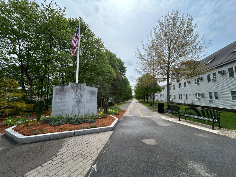
World War II Veterans Memorial Trail
A paved rail trail of about 6.6 miles from downtown Mansfield to Norton, on the rail line that carried soldiers to Camp Myles Standish in World War II. People walk and ride it for flat, easy miles through woods and wetlands, with a short trip from the Mansfield train station.
- 长度
- 6.6 英里
- rail trail
- 路面
- 大部分铺装
- 入口
- 4 处
- 见地图
从downtown Mansfield到Crane Street lot
每个入口都可停车 · 查看位置
从 Mansfield 站乘火车返回 · 下几班火车
开放。 截至 2026年10月19日 无封闭。
从哪里进入
North end, Old Colony Road near East Street, downtown Mansfield
North end of the trail. A side path along Old Colony Road leads toward the train station.
- Mansfield commuter rail station (Providence/Stoughton Line), about half a mile north along Old Colony Road
- Public parking in downtown Mansfield on Old Colony Road.
Fruit Street lots, Mansfield
Just past Mansfield Municipal Airport. Near the short unpaved stretch.
- Two small trail lots at Fruit Street.
Cobb Street lot, Norton
Here the trail leaves the old rail bed and follows Cobb Street and North Washington Street to cross over I-495 on a separated bike lane.
- Small trail lot (about 91 Cobb Street).
Crane Street lot, Norton (south end)
South end of the trail. The old rail bed goes on south but is not built.
- Small trail lot at the Crane Street end.
如何到达
- 乘公交
- Take the MBTA Providence/Stoughton Line to Mansfield station, then go about half a mile south along Old Colony Road to the trail's north end.
- 停车
- Small free lots at Fruit Street (Mansfield), Cobb Street and Crane Street (Norton), plus public parking in downtown Mansfield.
展开收起
TrailLink also lists a lot at the Winthrop Dahl Nature Preserve on North Washington Street in Norton.
骑车去,坐火车回
沿步道单程骑行,再乘通勤铁路返回。Mansfield 站距the trail's north end 0.4 英里。
这条步道上的 Roam
Roam 是一条沿途设有站点的自助路线。免费的 Shift 应用会在每个站点为你签到,走完即可解锁徽章。
整条步道
WWII Veterans Memorial Trail
From a WWII staging ground to protected wetlands and rare cedar swamps
3.4 英里 22 分钟在 Shift 应用中
免费下载 Shift。 跟着 Roam 走,有前往每个站点的逐步导航,出发前还能看到步道的封闭信息。


关于World War II Veterans Memorial Trail
- 路面
- Paved, except a short unpaved piece near Mansfield Municipal Airport (left unpaved because of conservation rules). A stone dust path runs next to the paved trail in part of Mansfield.
- 规定
- The Friends group says the trail is open to horseback riders, cyclists, walkers and runners.
- 餐饮
- Downtown Mansfield, at the north end.
- 管理单位
- Towns of Mansfield and Norton (each town's section), with help from the Friends of the WWII Veterans Memorial Trail
- 别名
- Norton Rail Trail, Norton Rail-Trail, WWII Veterans Memorial Trail, WW2 Rail Trail, Mansfield rail trail
这些信息的来源2026年10月19日 核实
- traillink.com/trail/world-war-ii-veterans-memorial-trailnorton-rail-trail
- masstrails10.org/wwii-veterans-trail.html
- ww2railtrail.org
- ww2railtrail.org/friends
- bikeitorhikeit.org/ww_ll_veterans_memorial_trail.htm
- travel.yahoo.com/guides/articles/wwii-veterans-memorial-trail-mansfield-090431331.html
- mass.gov/event/norton-nortonmansfield-rail-trail-extension-project-in-nortonmansfield-08-15-2019
- beta-inc.com/project/norton-mansfield-rail-trail-extension
- mass.streetsblog.org/2024/12/30/new-trails-we-can-look-forward-to-in-2025
- railstotrails.org/trailblog/rail-trails-honoring-americas-veterans
- openstreetmap.org/relation/20316035