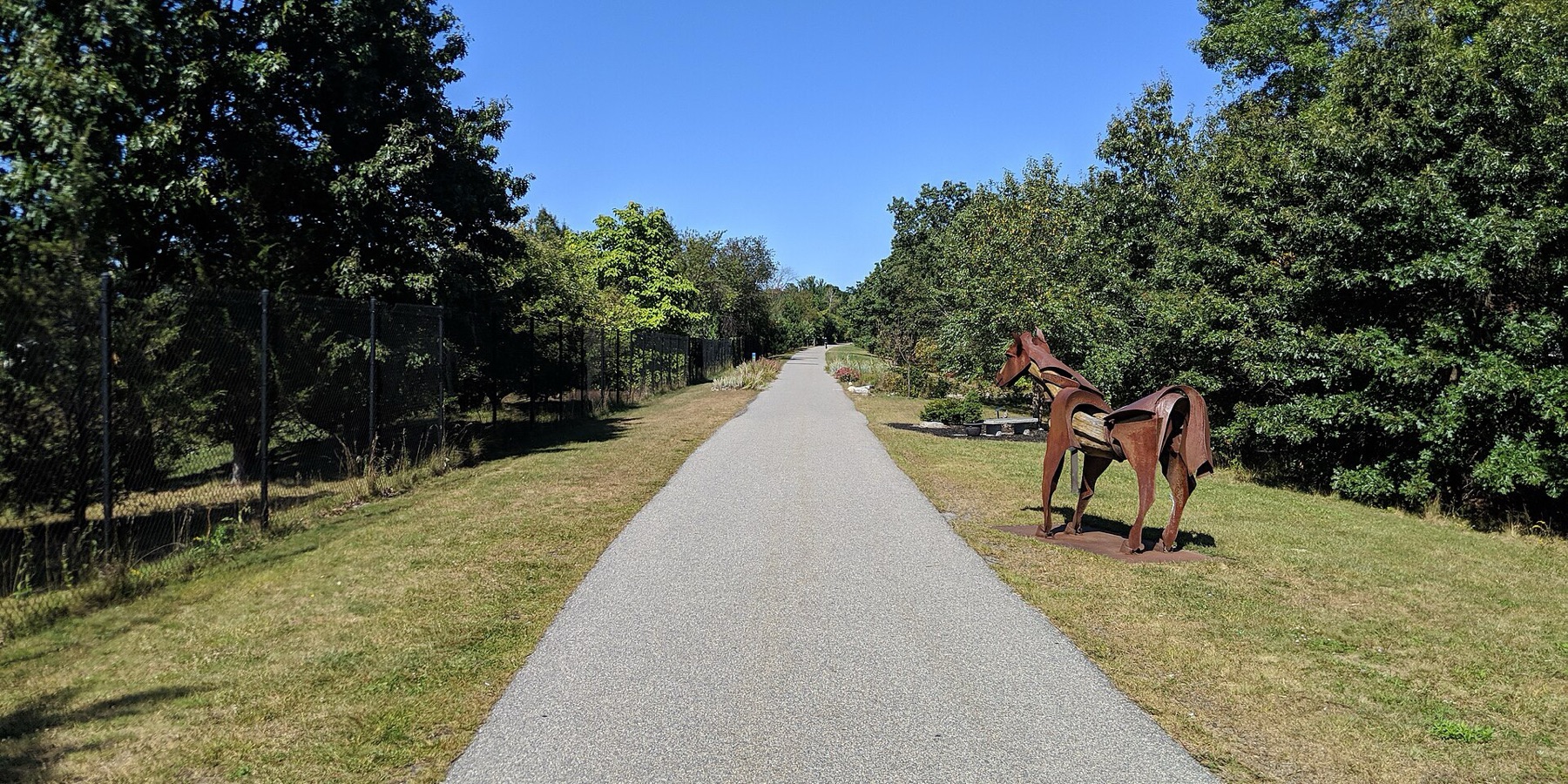
Clipper City Rail Trail
The Clipper City Rail Trail is a paved loop of about 3.4 miles that links the Newburyport train station, downtown and the Merrimack River waterfront. People use it to walk or bike from the train to downtown and to ride an easy loop past the harbor.
- 长度
- 3.4 英里
- rail trail
- 路面
- 铺装路面
- 全程
- 入口
- 8 处
- 见地图
环线途经Newburyport, Newbury
8 个入口中有 5 个可停车 · 查看位置
从 Newburyport 站乘火车返回 · 下几班火车
开放。 截至 2026年10月19日 无封闭。
从哪里进入
Newburyport MBTA station
Southern start of the loop. Port Bikeshare has a station near the commuter rail station.
- Newburyport station, Newburyport/Rockport Line commuter rail (about 200 m)
- Paid MBTA lots.
Low Street (Graf Skating Rink)
The trail goes over Low Street on a bridge here.
- Free parking at the Graf Skating Rink, west of the trail. A paved connector runs from behind the rink to the trail.
Washington Street
Port Bikeshare has a station on Washington Street.
- Limited on-street parking. Free parking at Cushing Park on Kent Street nearby.
Merrimack River end, Gillis Bridge connector and Harborwalk
North end of the first phase. The Harborwalk heads west along the river, and a connector goes up to the Route 1 Gillis Bridge to Salisbury's trails.
路线导航Downtown waterfront boardwalk (Market Landing Park)
Boardwalk along the downtown waterfront. Port Bikeshare stations at Market Landing Park and next to the American Yacht Club.
- MeVa Transit routes 19 and 20 run hourly between the train station and downtown
Joppa, Water Street
Riverfront section through the South End, opened in 2021 after shoreline work.
路线导航Parker Street at State Street (Oak Hill Cemetery)
Last link of the loop, back toward the station. Signal-controlled crossings on Parker and State streets.
- A few free spaces on Parker Street.
如何到达
- 乘公交
- Newburyport station (Newburyport/Rockport Line commuter rail) sits at the south end of the loop.
展开收起
From the station it is about a 1 mile walk on the trail to downtown. MeVa Transit routes 19 and 20 run hourly between the station and downtown.
- 共享单车
- Port Bikeshare (a city pilot started November 2025, relaunched April 2026) has five stations: near the MBTA station, on Washington Street, at Market Landing Park, next to the American Yacht Club, and off High Street at March's Hill.
展开收起
No Bluebikes here.
- 停车
- Free parking at the Graf Skating Rink on Low Street, at Cushing Park on Kent Street, on High Street and a few spaces on Parker Street.
展开收起
Paid parking in the MBTA station lots. Washington Street has limited on-street parking.
骑车去,坐火车回
沿步道单程骑行,再乘通勤铁路返回。Newburyport 站就在步道上。
这条步道上的 Roam
Roam 是一条沿途设有站点的自助路线。免费的 Shift 应用会在每个站点为你签到,走完即可解锁徽章。
整条步道
Clipper City Rail Trail
A flat, paved loop from the Newburyport train station to the Merrimack River and back
4.6 英里 35 分钟在 Shift 应用中
免费下载 Shift。 跟着 Roam 走,有前往每个站点的逐步导航,出发前还能看到步道的封闭信息。


继续前行
Clipper City Rail Trail与其他步道和受保护的自行车道相连。选择一个方向,在地图上查看。
这条步道 可以继续的路线 其他自行车道
关于Clipper City Rail Trail
- 路面
- Paved the whole loop. Some waterfront parts are wooden boardwalk, and the Harborwalk along the Merrimack River is a mix of paths and boardwalk.
- 管理单位
- City of Newburyport (Office of Planning and Development)
- 别名
- Clipper City Rail Trail and Harborwalk, Newburyport Rail Trail, Newburyport Harborwalk, Border to Boston Trail (Newburyport)
这些信息的来源2026年10月19日 核实
- cityofnewburyport.com/planning-development/clipper-city-rail-trail-harborwalk
- coastaltrails.org/the-trail-network/clipper-city-rail-trail-newburyport
- coastaltrails.org/whats-new
- coastaltrails.org/2018-ctc-progress-report
- newburyportnews.com/news/local_news/city-last-section-of-rail-trail-almost-done/article_827109d8-76a9-11ef-b4f8-e76a81adb518.html
- thetowncommon.com/2021/06/12/waterfront-rail-trail-gap-now-open
- mass.streetsblog.org/2026/10/19/mbta-will-run-special-rails-and-trails-excursion-train-to-newburyport-on-nov-7
- ncmhub.org/2026/04/01/newburyport-celebrates-relaunch-of-port-bikeshare-program
- traillink.com/trail/clipper-city-rail-trail
- trailspotting.com/2023/04/newburyport-rail-trails-ma.html
- api-v3.mbta.com/stops
- https://www.openstreetmap.org (Overpass API, Clipper City Rail Trail and Harborwalk ways)