Clipper City Rail Trail
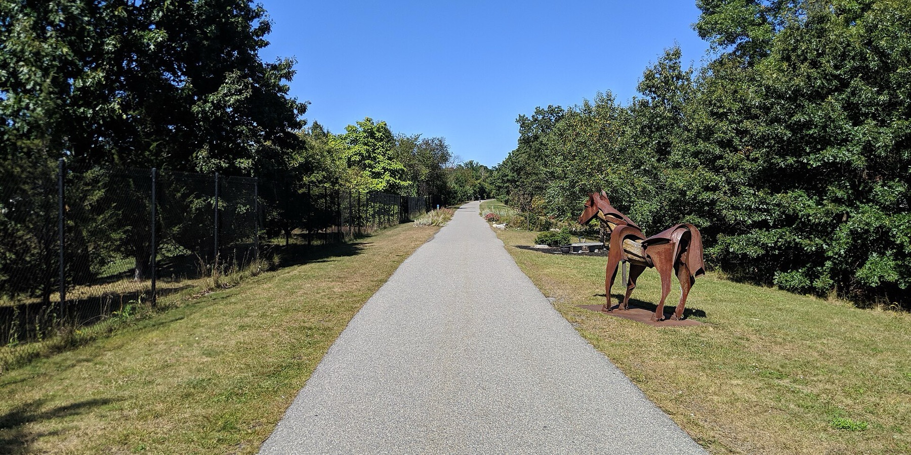
The Clipper City Rail Trail is a paved loop of about 3.4 miles that links the Newburyport train station, downtown and the Merrimack River waterfront. People use it to walk or bike from the train to downtown and to ride an easy loop past the harbor.
- Distância
- 3.4 mi
- rail trail
- Piso
- Pavimentado
- o caminho todo
- Onde entrar
- 8 lugares
- no mapa
Circuito por Newburyport, Newbury
Estacionamento em 5 dos 8 lugares para entrar · Ver onde
Trem de volta da estação Newburyport · Próximos trens
Aberta. Sem interdições em 19 de out. de 2026.
Onde entrar
Os números correspondem à lista; P tem estacionamento.
Baixar o GPXPara Ride with GPS, Strava, Komoot ou um ciclocomputador.
Newburyport MBTA station
Southern start of the loop. Port Bikeshare has a station near the commuter rail station.
- Newburyport station, Newburyport/Rockport Line commuter rail (about 200 m)
- Paid MBTA lots.
Low Street (Graf Skating Rink)
The trail goes over Low Street on a bridge here.
- Free parking at the Graf Skating Rink, west of the trail. A paved connector runs from behind the rink to the trail.
Washington Street
Port Bikeshare has a station on Washington Street.
- Limited on-street parking. Free parking at Cushing Park on Kent Street nearby.
Merrimack River end, Gillis Bridge connector and Harborwalk
North end of the first phase. The Harborwalk heads west along the river, and a connector goes up to the Route 1 Gillis Bridge to Salisbury's trails.
Como chegarDowntown waterfront boardwalk (Market Landing Park)
Boardwalk along the downtown waterfront. Port Bikeshare stations at Market Landing Park and next to the American Yacht Club.
- MeVa Transit routes 19 and 20 run hourly between the train station and downtown
Joppa, Water Street
Riverfront section through the South End, opened in 2021 after shoreline work.
Como chegarHigh Street (Route 1A)
Trail passes under High Street.
- Free on-street parking on High Street.
Parker Street at State Street (Oak Hill Cemetery)
Last link of the loop, back toward the station. Signal-controlled crossings on Parker and State streets.
- A few free spaces on Parker Street.
Como chegar
- De transporte público
- Newburyport station (Newburyport/Rockport Line commuter rail) sits at the south end of the loop.
MaisMenos
From the station it is about a 1 mile walk on the trail to downtown. MeVa Transit routes 19 and 20 run hourly between the station and downtown.
- Bicicletas compartilhadas
- Port Bikeshare (a city pilot started November 2025, relaunched April 2026) has five stations: near the MBTA station, on Washington Street, at Market Landing Park, next to the American Yacht Club, and off High Street at March's Hill.
MaisMenos
No Bluebikes here.
- Estacionamento
- Free parking at the Graf Skating Rink on Low Street, at Cushing Park on Kent Street, on High Street and a few spaces on Parker Street.
MaisMenos
Paid parking in the MBTA station lots. Washington Street has limited on-street parking.
Ida de bicicleta, volta de trem
Pedale a trilha em um sentido e volte de trem regional. A estação Newburyport fica bem na trilha.
Um Roam nesta trilha
Um Roam é uma rota autoguiada com paradas pelo caminho. O app gratuito Shift faz seu check-in em cada parada, e no fim você desbloqueia um distintivo.
A trilha inteira
Clipper City Rail Trail
A flat, paved loop from the Newburyport train station to the Merrimack River and back
4.6 mi 35 minNo app Shift
Baixe o Shift, grátis. Siga um Roam com instruções passo a passo até cada parada e veja as interdições nas suas trilhas antes de sair.


Continue
Clipper City Rail Trail se liga a outros caminhos e ciclovias protegidas. Escolha uma direção para ver no mapa.
Esta trilha Por onde continuar Outras ciclovias
Sobre Clipper City Rail Trail
- Piso
- Paved the whole loop. Some waterfront parts are wooden boardwalk, and the Harborwalk along the Merrimack River is a mix of paths and boardwalk.
- Quem cuida
- City of Newburyport (Office of Planning and Development)
- Também chamada
- Clipper City Rail Trail and Harborwalk, Newburyport Rail Trail, Newburyport Harborwalk, Border to Boston Trail (Newburyport)
Mais sobre a trilha
- Página oficial · cityofnewburyport.com
- Amigos da trilha · coastaltrails.org
De onde vêm estas informaçõesVerificado em 19 de out. de 2026
- cityofnewburyport.com/planning-development/clipper-city-rail-trail-harborwalk
- coastaltrails.org/the-trail-network/clipper-city-rail-trail-newburyport
- coastaltrails.org/whats-new
- coastaltrails.org/2018-ctc-progress-report
- newburyportnews.com/news/local_news/city-last-section-of-rail-trail-almost-done/article_827109d8-76a9-11ef-b4f8-e76a81adb518.html
- thetowncommon.com/2021/06/12/waterfront-rail-trail-gap-now-open
- mass.streetsblog.org/2026/10/19/mbta-will-run-special-rails-and-trails-excursion-train-to-newburyport-on-nov-7
- ncmhub.org/2026/04/01/newburyport-celebrates-relaunch-of-port-bikeshare-program
- traillink.com/trail/clipper-city-rail-trail
- trailspotting.com/2023/04/newburyport-rail-trails-ma.html
- api-v3.mbta.com/stops
- https://www.openstreetmap.org (Overpass API, Clipper City Rail Trail and Harborwalk ways)