Marblehead Rail Trail
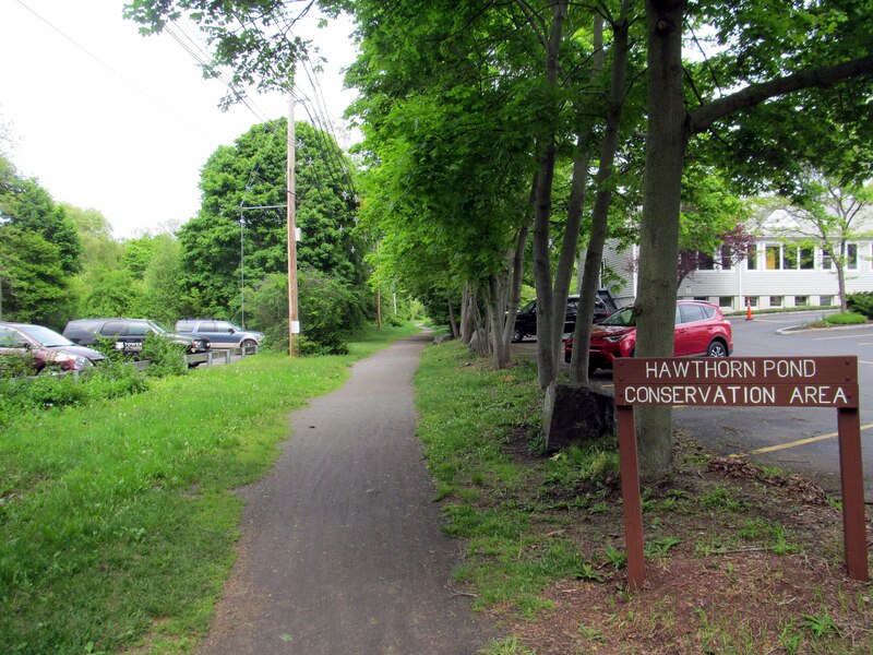
The Marblehead Rail Trail is a flat dirt and stone dust path on two old rail lines that run from Marblehead center to Salem and to Swampscott. People walk, run and ride it through woods, marsh and quiet neighborhoods near the shore.
- 长度
- 4.5 英里
- rail trail
- 路面
- 未铺装
- 细碎石
- 入口
- 7 处
- 见地图
从Lafayette Street到Bradlee Avenue
7 个入口中有 2 个可停车 · 查看位置
开放。 截至 2026年10月19日 无封闭。
从哪里进入
Lafayette Street (Route 114), Salem
West end of the Salem branch. The paved Salem Bike Path (Mayor Anthony V. Salvo path) starts here and runs north past Salem State to Mill Street near downtown Salem. Busy road crossing; use care.
- MBTA bus 455 on Loring Ave (about 600 m). Salem station (Newburyport/Rockport Line) is about 2 miles north via the Salem Bike Path.
- Paid parking near Salem State University, on the Salem Bike Path.
Bessom Street, Marblehead (near Pleasant Street)
Marblehead end of the trail, near the town center. The two branches meet just west of here.
- MBTA bus 441, 442 at Pleasant St @ Bessom St (about 160 m)
Bradlee Avenue, Swampscott
South end of the trail. The last 1,200 feet or so is the Swampscott Rail Trail, built in 2020. Phillips and Preston beaches are about half a mile away.
- MBTA bus 441, 442 at Humphrey St @ Beach Bluff Ave (about 250 m)
- Free street parking on Bradlee Avenue.
如何到达
- 乘公交
- MBTA buses 441 and 442 run on Humphrey Street and Pleasant Street, close to the Swampscott and Marblehead ends.
展开收起
Bus 455 runs on Loring Avenue in Salem. From Salem station (Newburyport/Rockport Line), ride the paved Salem Bike Path about 2 miles south to the trail at Lafayette Street.
- 共享单车
- Bluebikes stations on the connecting Salem Bike Path: 'Salem State University - Bike Path at Loring Ave' and 'Mayor Salvo Path at Mill St'.
展开收起
There are none on the Marblehead Rail Trail itself.
- 停车
- Parking is limited. Free street parking on Bradlee Avenue in Swampscott at the south end. Paid parking near Salem State University on the connecting Salem Bike Path.
这条步道上的 Roam
Roam 是一条沿途设有站点的自助路线。免费的 Shift 应用会在每个站点为你签到,走完即可解锁徽章。
整条步道
Marblehead Rail Trail
Two historic seaports, tide pools, and a thousand years of stories
5.5 英里 39 分钟在 Shift 应用中
免费下载 Shift。 跟着 Roam 走,有前往每个站点的逐步导航,出发前还能看到步道的封闭信息。


继续前行
Marblehead Rail Trail与其他步道和受保护的自行车道相连。选择一个方向,在地图上查看。
这条步道 可以继续的路线 其他自行车道
关于Marblehead Rail Trail
- 路面
- Mostly hard-packed dirt and stone dust, with muddy spots after rain. A 650-foot section between Smith and Pleasant streets was rebuilt in 2025 with crushed aggregate, 11 feet wide. The short Swampscott piece is crushed stone. The Salem Bike Path that connects at Lafayette Street is paved.
- 规定
- Dogs must be on a leash everywhere in Marblehead, including the rail trails (Town of Marblehead Animal Control notice).
- 管理单位
- Town of Marblehead (Department of Community Development and Planning). The short Swampscott section belongs to the Town of Swampscott.
- 别名
- Marblehead Rail-Trail, The Path, Marblehead Rail Trails, Swampscott Rail Trail, Salem Branch, Swampscott Branch
更多步道信息
- 官方页面 · marbleheadma.gov
这些信息的来源2026年10月19日 核实
- marbleheadma.gov/rail-trail-project
- marbleheadweeklynews.com/state-awards-marblehead-718k-for-rail-trail
- marbleheadcurrent.org/2026/09/17/conservancy-airs-concerns-as-rail-trail-work-advances
- marbleheadcurrent.org/2025/09/02/rail-trail-ribbon-cutting-marks-milestone-in-years-long-project
- marbleheadma.gov/rail-trail-work-notice-august-24-28-august-31-september-1
- marbleheadma.gov/wp-content/uploads/2025/07/Notice-of-Rail-Trail-Detour-Clifton-to-Rockaway.pdf
- marblehead.org/node/97306
- trailspotting.com/2022/12/marblehead-salem-rail-trails-ma.html
- traillink.com/trail/marblehead-rail-trail
- traillink.com/trail/salem-bike-path
- hwy.massdot.state.ma.us/ProjectInfo/Main.asp
- swampscottrailtrail.org/latest-news
- gbfs.bluebikes.com/gbfs/en/station_information.json
- api-v3.mbta.com/stops
- https://www.openstreetmap.org (Overpass API, Marblehead Rail Trail, Swampscott Rail Trail, Mayor Anthony Salvo Bike Path ways)