Marblehead Rail Trail
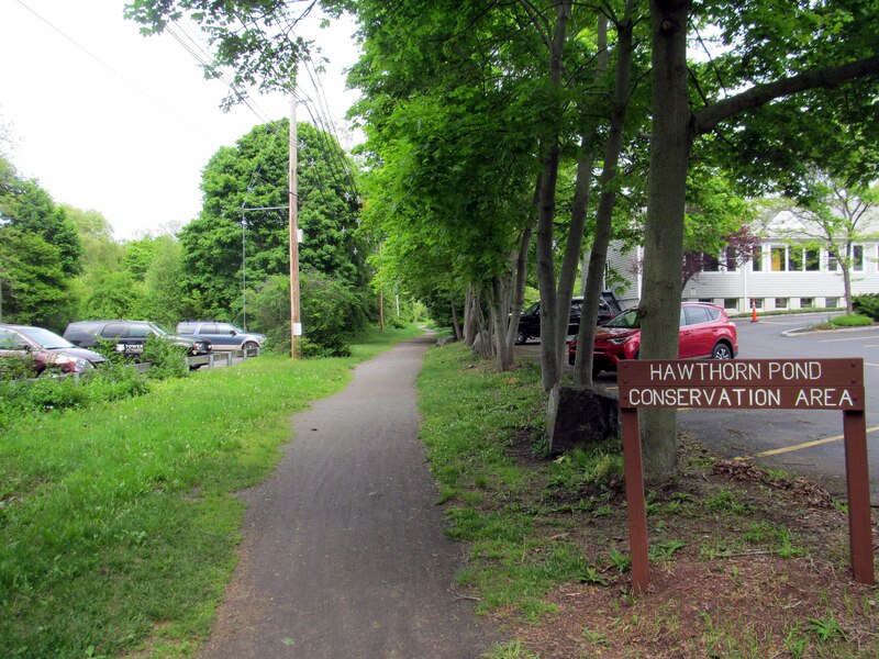
The Marblehead Rail Trail is a flat dirt and stone dust path on two old rail lines that run from Marblehead center to Salem and to Swampscott. People walk, run and ride it through woods, marsh and quiet neighborhoods near the shore.
- Distância
- 4.5 mi
- rail trail
- Piso
- Sem pavimento
- cascalho fino
- Onde entrar
- 7 lugares
- no mapa
De Lafayette Street a Bradlee Avenue
Estacionamento em 2 dos 7 lugares para entrar · Ver onde
Aberta. Sem interdições em 19 de out. de 2026.
Onde entrar
Os números correspondem à lista; P tem estacionamento.
Baixar o GPXPara Ride with GPS, Strava, Komoot ou um ciclocomputador.
Lafayette Street (Route 114), Salem
West end of the Salem branch. The paved Salem Bike Path (Mayor Anthony V. Salvo path) starts here and runs north past Salem State to Mill Street near downtown Salem. Busy road crossing; use care.
- MBTA bus 455 on Loring Ave (about 600 m). Salem station (Newburyport/Rockport Line) is about 2 miles north via the Salem Bike Path.
- Paid parking near Salem State University, on the Salem Bike Path.
Bessom Street, Marblehead (near Pleasant Street)
Marblehead end of the trail, near the town center. The two branches meet just west of here.
- MBTA bus 441, 442 at Pleasant St @ Bessom St (about 160 m)
Smith Street, Marblehead
South end of the rebuilt Smith to Pleasant Street section (2025).
Como chegarBradlee Avenue, Swampscott
South end of the trail. The last 1,200 feet or so is the Swampscott Rail Trail, built in 2020. Phillips and Preston beaches are about half a mile away.
- MBTA bus 441, 442 at Humphrey St @ Beach Bluff Ave (about 250 m)
- Free street parking on Bradlee Avenue.
Como chegar
- De transporte público
- MBTA buses 441 and 442 run on Humphrey Street and Pleasant Street, close to the Swampscott and Marblehead ends.
MaisMenos
Bus 455 runs on Loring Avenue in Salem. From Salem station (Newburyport/Rockport Line), ride the paved Salem Bike Path about 2 miles south to the trail at Lafayette Street.
- Bicicletas compartilhadas
- Bluebikes stations on the connecting Salem Bike Path: 'Salem State University - Bike Path at Loring Ave' and 'Mayor Salvo Path at Mill St'.
MaisMenos
There are none on the Marblehead Rail Trail itself.
- Estacionamento
- Parking is limited. Free street parking on Bradlee Avenue in Swampscott at the south end. Paid parking near Salem State University on the connecting Salem Bike Path.
Um Roam nesta trilha
Um Roam é uma rota autoguiada com paradas pelo caminho. O app gratuito Shift faz seu check-in em cada parada, e no fim você desbloqueia um distintivo.
A trilha inteira
Marblehead Rail Trail
Two historic seaports, tide pools, and a thousand years of stories
5.5 mi 39 minNo app Shift
Baixe o Shift, grátis. Siga um Roam com instruções passo a passo até cada parada e veja as interdições nas suas trilhas antes de sair.


Continue
Marblehead Rail Trail se liga a outros caminhos e ciclovias protegidas. Escolha uma direção para ver no mapa.
Esta trilha Por onde continuar Outras ciclovias
Sobre Marblehead Rail Trail
- Piso
- Mostly hard-packed dirt and stone dust, with muddy spots after rain. A 650-foot section between Smith and Pleasant streets was rebuilt in 2025 with crushed aggregate, 11 feet wide. The short Swampscott piece is crushed stone. The Salem Bike Path that connects at Lafayette Street is paved.
- Regras
- Dogs must be on a leash everywhere in Marblehead, including the rail trails (Town of Marblehead Animal Control notice).
- Quem cuida
- Town of Marblehead (Department of Community Development and Planning). The short Swampscott section belongs to the Town of Swampscott.
- Também chamada
- Marblehead Rail-Trail, The Path, Marblehead Rail Trails, Swampscott Rail Trail, Salem Branch, Swampscott Branch
Mais sobre a trilha
- Página oficial · marbleheadma.gov
De onde vêm estas informaçõesVerificado em 19 de out. de 2026
- marbleheadma.gov/rail-trail-project
- marbleheadweeklynews.com/state-awards-marblehead-718k-for-rail-trail
- marbleheadcurrent.org/2026/09/17/conservancy-airs-concerns-as-rail-trail-work-advances
- marbleheadcurrent.org/2025/09/02/rail-trail-ribbon-cutting-marks-milestone-in-years-long-project
- marbleheadma.gov/rail-trail-work-notice-august-24-28-august-31-september-1
- marbleheadma.gov/wp-content/uploads/2025/07/Notice-of-Rail-Trail-Detour-Clifton-to-Rockaway.pdf
- marblehead.org/node/97306
- trailspotting.com/2022/12/marblehead-salem-rail-trails-ma.html
- traillink.com/trail/marblehead-rail-trail
- traillink.com/trail/salem-bike-path
- hwy.massdot.state.ma.us/ProjectInfo/Main.asp
- swampscottrailtrail.org/latest-news
- gbfs.bluebikes.com/gbfs/en/station_information.json
- api-v3.mbta.com/stops
- https://www.openstreetmap.org (Overpass API, Marblehead Rail Trail, Swampscott Rail Trail, Mayor Anthony Salvo Bike Path ways)