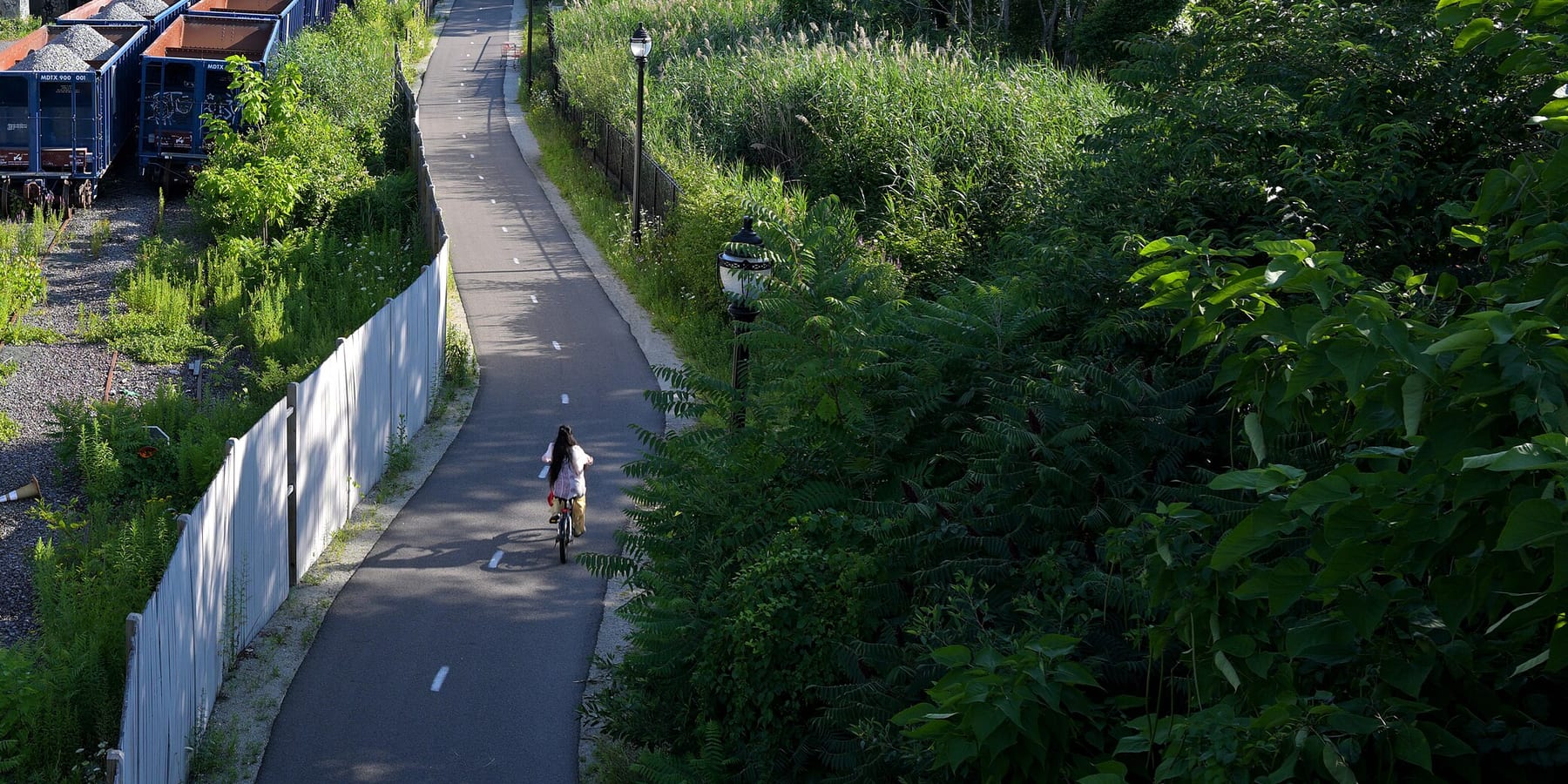
Northern Strand Trail
The Northern Strand is a paved path on an old rail line that runs about 10 miles from Everett through Malden, Revere and Saugus to West Lynn. People use it to get to work and school, to ride with kids away from traffic, and to reach the North Shore by bike.
- Distância
- 9.9 mi
- rail trail
- Piso
- Pavimentado
- o caminho todo
- Onde entrar
- 8 lugares
- no mapa
De Gateway Center / Encore Riverwalk connector a Western Avenue
Estacionamento em 1 dos 8 lugares para entrar · Ver onde
Trem de volta da estação Lynn · Próximos trens
Limpa em parte no inverno · Quem limpa
Onde entrar
Os números correspondem à lista; P tem estacionamento.
Baixar o GPXPara Ride with GPS, Strava, Komoot ou um ciclocomputador.
Gateway Center / Encore Riverwalk connector, Everett
Southern end of the trail, behind Gateway Center. A Bluebikes station (Encore) is about 270 m away.
- MBTA bus 97 and 99 at Gateway Center @ Target (about 300 m)
West Street and Wellington Avenue, Everett
Bluebikes station 'Northern Strand - West St & Wellington Ave' is right on the trail.
Como chegarBike to the Sea Bike Kitchen, Canal Street, Malden
Bike to the Sea's Bike Kitchen (158 Canal St) is on the trail. Bluebikes station 'Northern Strand at Bike Kitchen' is here.
- Malden Center (Orange Line and Haverhill Line) is about a third of a mile northeast. MBTA bus 97 on Medford St (about 300 m).
Centre Street (Route 60) by Malden High School, Malden
Bluebikes station 'Malden High School' is about 40 m away.
- MBTA bus 105 on Eastern Ave, buses 106, 108, 411 and 430 on Salem St, bus 104 on Ferry St (all within about 250 m)
- Bike to the Sea's map points to the hockey rink lot on Route 60 across from Malden High.
Linden Square, Lynn Street and Wesley Street (Malden/Revere line)
Where the trail passes from Malden into Revere.
- Linden Square bus stops: MBTA routes 108, 109, 119, 411, 426, 428, 429
Salem Street, Revere (near the Saugus line)
Bluebikes station 'Northern Strand at Salem Street' is on the trail.
- MBTA bus 426, 428, 429 at Salem St opp Franklin
Essex Street, Cliftondale, Saugus
Saugus section, near Cliftondale Square.
- MBTA bus 429, 430 at Essex St opp School St
Western Avenue (Route 107), West Lynn
Current end of the open trail. The new extension through downtown Lynn to Nahant Beach starts here and is still under construction.
- MBTA buses 424, 426, 436, 441, 442, 450, 455 at 743 and 760 Western Ave
Como chegar
- De transporte público
- Malden Center (Orange Line and Haverhill Line commuter rail) is about a third of a mile from the trail near the Bike Kitchen.
MaisMenos
Many MBTA bus routes cross the trail, with the most at Linden Square and on Western Avenue in Lynn. Lynn's commuter rail station is being rebuilt, and Newburyport/Rockport Line trains now stop at Lynn Interim (11 Ellis St), about 1.4 miles past the trail's Western Avenue end.
- Bicicletas compartilhadas
Perto de Gateway Center / Encore Riverwalk connector, agora
- Encorea 3 min a pé · 4 bicicletas
- Broadway at Lynde Sta 6 min a pé · 1 bicicleta
- Estacionamento
- Bike to the Sea says there are many informal access points with free parking along the trail, and its trail map shows suggested spots.
MaisMenos
The one it names is the hockey rink lot on Route 60 across from Malden High School.
Ida de bicicleta, volta de trem
Pedale a trilha em um sentido e volte de trem regional. A estação Lynn fica a 1.4 milhas de the trail's end at Western Avenue.
Um Roam nesta trilha
Um Roam é uma rota autoguiada com paradas pelo caminho. O app gratuito Shift faz seu check-in em cada parada, e no fim você desbloqueia um distintivo.
A trilha inteira
Northern Strand Trail
A paved rail trail from the Mystic River to Lynn, straight across the Rumney Marsh
9.3 mi 1 hNo app Shift
Baixe o Shift, grátis. Siga um Roam com instruções passo a passo até cada parada e veja as interdições nas suas trilhas antes de sair.


Continue
Northern Strand Trail se liga a outros caminhos e ciclovias protegidas. Escolha uma direção para ver no mapa.
Esta trilha Por onde continuar Outras ciclovias
Sobre Northern Strand Trail
- Piso
- Paved (asphalt) the whole way from Everett to Western Avenue in Lynn.
- Regras
- Motor vehicles are not allowed.
- No inverno
- Malden plows its 3 miles when it plows the streets, but not for an inch of snow, and does not salt. Other towns may not. Fonte
- Condições de todas as trilhas
- Água
- Bike to the Sea says there are water fountains along the trail, but does not list where.
- Quem cuida
- Owned and run by the cities and towns it passes through (Everett, Malden, Revere, Saugus, Lynn) on former rail land leased from the MBTA. Bike to the Sea, a nonprofit, planned it with the cities and still looks after it. MassDOT is building the Lynn extension.
- Também chamada
- Northern Strand Trail, Northern Strand, Bike to the Sea Trail, Saugus Branch rail trail, Border to Boston Trail (southern section)
Avisos
Obras e mudanças ao longo da trilha, com o desvio quando houver.
Lynn extension not open yet. MassDOT is building a two-way protected bike path (about 1.9 miles) on Market Square, South Common St, Market St, the Lynnway and Nahant Road, with lane, sidewalk and parking changes in downtown Lynn.
From the trail's end at Western Avenue in Lynn through downtown Lynn to Nahant Beach
MassDOT plans to finish by 15 de nov. de 2026. No official detour. Riders going past Western Avenue use city streets through active construction.
Fonte
Mais sobre a trilha
- Amigos da trilha · biketothesea.org
De onde vêm estas informaçõesVerificado em 19 de out. de 2026
- biketothesea.org
- biketothesea.org/faqs
- biketothesea.org/map
- biketothesea.org/detours-and-alternative-rides
- traillink.com/trail/northern-strand-community-trail
- en.wikipedia.org/wiki/Northern_Strand_Community_Trail
- masstrailtracker.com/map
- citizenportal.ai/articles/8330078/Massachusetts/Essex-County/Lynn-City/MassDOT-outlines-timeline-for-Northern-Strand-bikelane-project-in-Lynn-councilors-press-safety-business-and-access-concerns
- mass.streetsblog.org/2025/12/23/new-trails-to-look-forward-to-in-2026
- mass.streetsblog.org/2025/06/16/eyes-on-the-street-the-northern-strand-gets-a-protected-path-through-downtown-lynn
- mass.streetsblog.org/2024/07/16/massdot-officially-breaks-ground-on-northern-strand-extension-through-downtown-lynn
- itemlive.com/2026/07/07/market-street-project-makes-lanes-sidewalks-and-parking-scarce
- gbfs.bluebikes.com/gbfs/en/station_information.json
- api-v3.mbta.com/stops
- https://www.openstreetmap.org (Overpass API, Northern Strand ways)