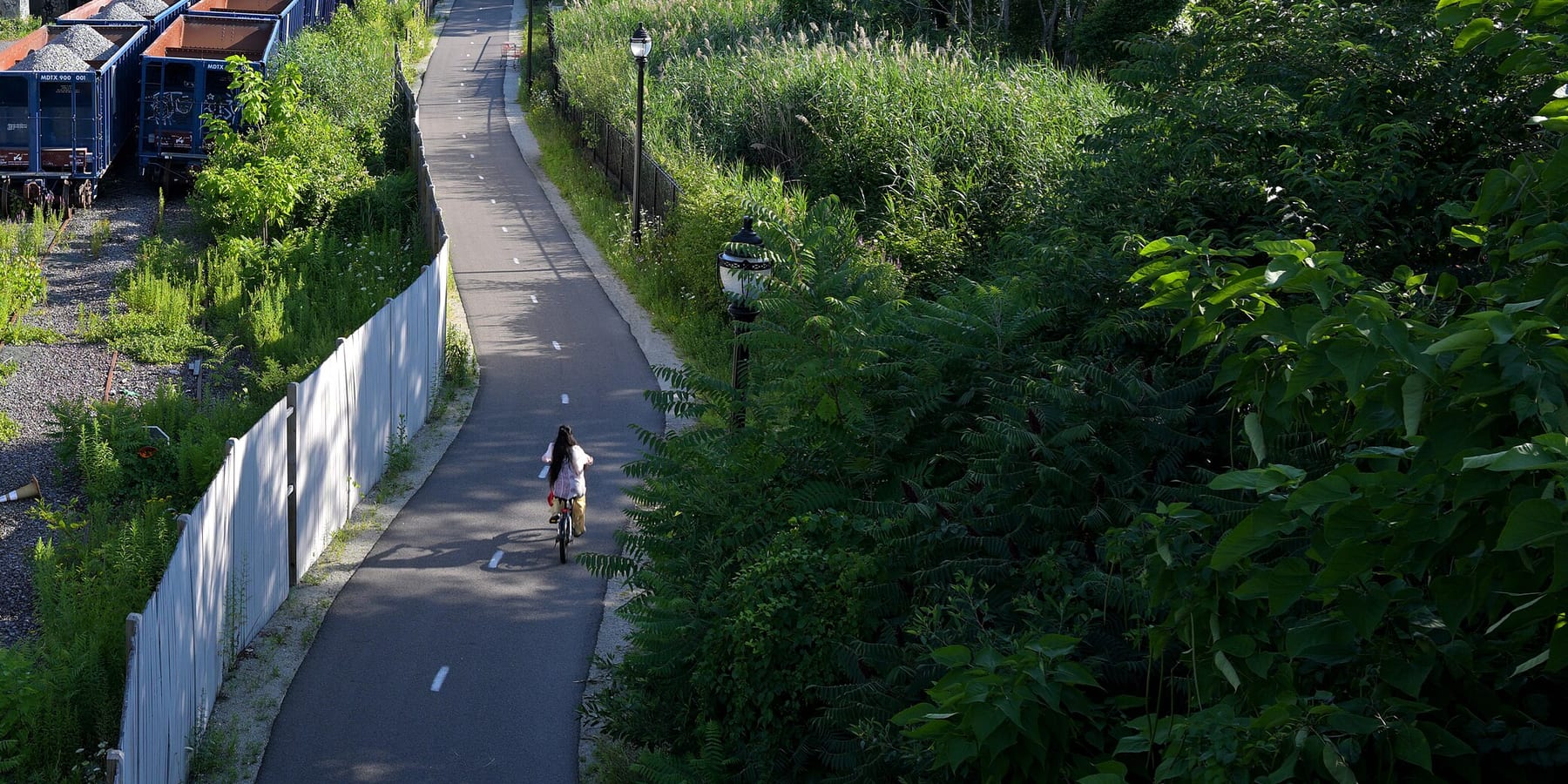
Northern Strand Trail
The Northern Strand is a paved path on an old rail line that runs about 10 miles from Everett through Malden, Revere and Saugus to West Lynn. People use it to get to work and school, to ride with kids away from traffic, and to reach the North Shore by bike.
- Distancia
- 9.9 mi
- rail trail
- Superficie
- Pavimentada
- todo el camino
- Dónde entrar
- 8 lugares
- en el mapa
De Gateway Center / Encore Riverwalk connector a Western Avenue
Estacionamiento en 1 de los 8 lugares para entrar · Ver dónde
Tren de regreso desde la estación Lynn · Próximos trenes
Se limpia en parte en invierno · Quién lo limpia
Dónde entrar
Los números corresponden a la lista; P tiene estacionamiento.
Descargar el GPXPara Ride with GPS, Strava, Komoot o un ciclocomputador.
Gateway Center / Encore Riverwalk connector, Everett
Southern end of the trail, behind Gateway Center. A Bluebikes station (Encore) is about 270 m away.
- MBTA bus 97 and 99 at Gateway Center @ Target (about 300 m)
West Street and Wellington Avenue, Everett
Bluebikes station 'Northern Strand - West St & Wellington Ave' is right on the trail.
Cómo llegarBike to the Sea Bike Kitchen, Canal Street, Malden
Bike to the Sea's Bike Kitchen (158 Canal St) is on the trail. Bluebikes station 'Northern Strand at Bike Kitchen' is here.
- Malden Center (Orange Line and Haverhill Line) is about a third of a mile northeast. MBTA bus 97 on Medford St (about 300 m).
Centre Street (Route 60) by Malden High School, Malden
Bluebikes station 'Malden High School' is about 40 m away.
- MBTA bus 105 on Eastern Ave, buses 106, 108, 411 and 430 on Salem St, bus 104 on Ferry St (all within about 250 m)
- Bike to the Sea's map points to the hockey rink lot on Route 60 across from Malden High.
Linden Square, Lynn Street and Wesley Street (Malden/Revere line)
Where the trail passes from Malden into Revere.
- Linden Square bus stops: MBTA routes 108, 109, 119, 411, 426, 428, 429
Salem Street, Revere (near the Saugus line)
Bluebikes station 'Northern Strand at Salem Street' is on the trail.
- MBTA bus 426, 428, 429 at Salem St opp Franklin
Essex Street, Cliftondale, Saugus
Saugus section, near Cliftondale Square.
- MBTA bus 429, 430 at Essex St opp School St
Western Avenue (Route 107), West Lynn
Current end of the open trail. The new extension through downtown Lynn to Nahant Beach starts here and is still under construction.
- MBTA buses 424, 426, 436, 441, 442, 450, 455 at 743 and 760 Western Ave
Cómo llegar
- En transporte público
- Malden Center (Orange Line and Haverhill Line commuter rail) is about a third of a mile from the trail near the Bike Kitchen.
MásMenos
Many MBTA bus routes cross the trail, with the most at Linden Square and on Western Avenue in Lynn. Lynn's commuter rail station is being rebuilt, and Newburyport/Rockport Line trains now stop at Lynn Interim (11 Ellis St), about 1.4 miles past the trail's Western Avenue end.
- Bicis compartidas
Cerca de Gateway Center / Encore Riverwalk connector, ahora
- Encorea 3 min a pie · 4 bicis
- Broadway at Lynde Sta 6 min a pie · 1 bici
- Estacionamiento
- Bike to the Sea says there are many informal access points with free parking along the trail, and its trail map shows suggested spots.
MásMenos
The one it names is the hockey rink lot on Route 60 across from Malden High School.
Ida en bici, vuelta en tren
Recorre el sendero en una dirección y regresa en el tren de cercanías. La estación Lynn está a 1.4 millas de the trail's end at Western Avenue.
Un Roam en este sendero
Un Roam es una ruta autoguiada con paradas en el camino. La app gratuita Shift registra tu llegada a cada parada y al final desbloqueas una insignia.
Todo el sendero
Northern Strand Trail
A paved rail trail from the Mystic River to Lynn, straight across the Rumney Marsh
9.3 mi 1 hEn la app Shift
Descarga Shift, gratis. Sigue un Roam con indicaciones paso a paso a cada parada y mira los cierres de tus senderos antes de salir.


Sigue adelante
Northern Strand Trail conecta con otros caminos y carriles bici protegidos. Elige una dirección para verla en el mapa.
Este sendero Por dónde seguir Otras ciclovías
Sobre Northern Strand Trail
- Superficie
- Paved (asphalt) the whole way from Everett to Western Avenue in Lynn.
- Normas
- Motor vehicles are not allowed.
- En invierno
- Malden plows its 3 miles when it plows the streets, but not for an inch of snow, and does not salt. Other towns may not. Fuente
- Estado de todos los senderos
- Agua
- Bike to the Sea says there are water fountains along the trail, but does not list where.
- Quién lo mantiene
- Owned and run by the cities and towns it passes through (Everett, Malden, Revere, Saugus, Lynn) on former rail land leased from the MBTA. Bike to the Sea, a nonprofit, planned it with the cities and still looks after it. MassDOT is building the Lynn extension.
- También llamado
- Northern Strand Trail, Northern Strand, Bike to the Sea Trail, Saugus Branch rail trail, Border to Boston Trail (southern section)
Avisos
Obras y cambios a lo largo del sendero, con el desvío cuando lo hay.
Lynn extension not open yet. MassDOT is building a two-way protected bike path (about 1.9 miles) on Market Square, South Common St, Market St, the Lynnway and Nahant Road, with lane, sidewalk and parking changes in downtown Lynn.
From the trail's end at Western Avenue in Lynn through downtown Lynn to Nahant Beach
MassDOT plans to finish by 15 nov 2026. No official detour. Riders going past Western Avenue use city streets through active construction.
Fuente
Más sobre el sendero
- Amigos del sendero · biketothesea.org
De dónde vienen estos datosRevisado el 19 oct 2026
- biketothesea.org
- biketothesea.org/faqs
- biketothesea.org/map
- biketothesea.org/detours-and-alternative-rides
- traillink.com/trail/northern-strand-community-trail
- en.wikipedia.org/wiki/Northern_Strand_Community_Trail
- masstrailtracker.com/map
- citizenportal.ai/articles/8330078/Massachusetts/Essex-County/Lynn-City/MassDOT-outlines-timeline-for-Northern-Strand-bikelane-project-in-Lynn-councilors-press-safety-business-and-access-concerns
- mass.streetsblog.org/2025/12/23/new-trails-to-look-forward-to-in-2026
- mass.streetsblog.org/2025/06/16/eyes-on-the-street-the-northern-strand-gets-a-protected-path-through-downtown-lynn
- mass.streetsblog.org/2024/07/16/massdot-officially-breaks-ground-on-northern-strand-extension-through-downtown-lynn
- itemlive.com/2026/07/07/market-street-project-makes-lanes-sidewalks-and-parking-scarce
- gbfs.bluebikes.com/gbfs/en/station_information.json
- api-v3.mbta.com/stops
- https://www.openstreetmap.org (Overpass API, Northern Strand ways)