Twin Cities Rail Trail
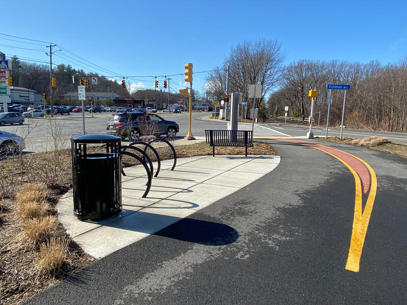
The Twin Cities Rail Trail is a paved path on an old rail line that links downtown Fitchburg and downtown Leominster. It runs along the North Nashua River and over a bridge across Route 2, so people use it for trips between the two cities and for easy rides and walks.
- Distância
- 4.1 mi
- rail trail
- Piso
- Pavimentado
- Onde entrar
- 5 lugares
- no mapa
De Fourth Street a Leominster Railroad Depot
Estacionamento em todos os lugares para entrar · Ver onde
Trem de volta da estação Fitchburg · Próximos trens
Limpa da neve no inverno · Quem limpa
Aberta. Sem interdições em 19 de out. de 2026.
Onde entrar
Os números correspondem à lista; P tem estacionamento.
Baixar o GPXPara Ride with GPS, Strava, Komoot ou um ciclocomputador.
Fourth Street, Fitchburg
North end of the off-street path. Riders reach First Street on Railroad Street. The bridge to Fitchburg station is being built.
- MBTA Fitchburg Line and MART buses at Fitchburg station (Intermodal Center), about a 10-minute ride on city streets
- Paid parking at the Fitchburg Intermodal station, a short ride away
Water Street (Route 12), near the city line
- MART Garage (City Line) stop, about 300 m (MART routes 1, 2, 3, 5, 6, 7, 8, 9, 11)
- Trail parking off Benson Street nearby (trail association map); exact lot not checked
Carter Park, Leominster
End of Phase 1. The trail goes on south to the old depot.
- MART stops at Monument Square, about 570 m
- Free parking by Carter Park along Main Street and Summer Street
Leominster Railroad Depot, Columbia Street
South end, at the old Victorian train depot. This last piece was built by the City of Leominster.
- MART Monument Square stops, about 230 m (MART routes 1, 2, 3, 8, 9)
- Free public lots in downtown Leominster
Como chegar
- De transporte público
- MBTA Fitchburg Line trains stop at Fitchburg station, about a 10-minute ride on city streets from the north end, and at North Leominster station, about a 10-minute ride from the south end.
MaisMenos
MART buses are fare-free right now. MART Route 2 runs about every half hour between downtown Fitchburg and downtown Leominster, and several routes stop at Monument Square in Leominster near the south end.
- Estacionamento
- Free lots at the Leominster end, by Carter Park and Doyle Field.
MaisMenos
Parking off Benson Street in Fitchburg. Paid parking at the Fitchburg Intermodal station.
Ida de bicicleta, volta de trem
Pedale a trilha em um sentido e volte de trem regional. A estação Fitchburg fica a 0.3 milhas de Fourth Street.
Um Roam nesta trilha
Um Roam é uma rota autoguiada com paradas pelo caminho. O app gratuito Shift faz seu check-in em cada parada, e no fim você desbloqueia um distintivo.
A trilha inteira
Twin Cities Rail Trail
Glacial boulders, Egyptian mummies, and the birthplace of the pink flamingo
4.3 mi 28 minNo app Shift
Baixe o Shift, grátis. Siga um Roam com instruções passo a passo até cada parada e veja as interdições nas suas trilhas antes de sair.


Sobre Twin Cities Rail Trail
- Piso
- paved, about 12 feet wide
- Regras
- Speed limit 15 mph. Keep right and pass on the left. Dogs on a leash, and pick up after them. Class 1 and Class 2 e-bikes and electric mobility devices are allowed. No gas-powered devices. (Twin Cities Trail Association rules page.)
- No inverno
- The Twin Cities Trail Association pays to plow the whole trail. Bridges can stay slushy or icy. Fonte, Jan 2023
- Condições de todas as trilhas
- Comida
- Downtown Leominster near the south end and downtown Fitchburg near the north end.
- Quem cuida
- The cities of Fitchburg and Leominster own the trail. The Twin Cities Trail Association does regular upkeep. MassDOT built Phase 1 and is building Phase 2.
- Também chamada
- TCRT, Fitchburg Leominster rail trail, Twin Cities Trail
Mais sobre a trilha
- Página oficial · twincitiestrail.com
De onde vêm estas informaçõesVerificado em 19 de out. de 2026
- masstrails10.org/twin-cities.html
- twincitiestrail.com
- twincitiestrail.com/rules
- twincitiestrail.com/news
- twincitiestrail.com/maps
- traillink.com/trail/twin-cities-rail-trail
- mass.streetsblog.org/2023/01/27/leominster-and-fitchburgs-new-rail-trail-gets-creative-with-winter-maintenance
- mass.gov/doc/fitchburg-twin-cities-rail-trail-construction-tcrt-phase-ii-presented-at-the-massdot-board-meeting-on-november-20-2024/download
- mass.gov/news/healey-driscoll-administration-celebrates-route-2-multimodal-bridge
- brownrowe.com/rail-trails-and-pathways/twin-cities-rail-trail
- api-v3.mbta.com/stops
- api-v3.mbta.com/alerts
- data.trilliumtransit.com/gtfs/montachusett-ma-us/montachusett-ma-us.zip
- openstreetmap.org/way/1040076115
- openstreetmap.org/way/1496646013