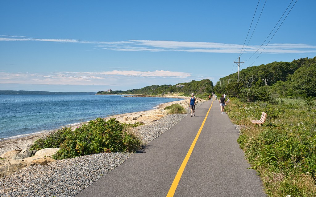
Shining Sea Bikeway
A paved 10.7-mile path on an old rail line from Woods Hole to North Falmouth. People ride and walk it for the ocean, marsh and pond views, and to reach the ferry, beaches and downtown Falmouth.
- Distância
- 10.7 mi
- rail trail
- Piso
- Pavimentado
- o caminho todo
- Onde entrar
- 6 lugares
- no mapa
De Woods Hole a North Falmouth
Estacionamento em todos os lugares para entrar · Ver onde
Limpa da neve no inverno · Quem limpa
Aberta. Sem interdições em 19 de out. de 2026.
Onde entrar
Os números correspondem à lista; P tem estacionamento.
Baixar o GPXPara Ride with GPS, Strava, Komoot ou um ciclocomputador.
Woods Hole, Steamship Authority ferry terminal
South end of the trail. Seasonal portable toilet at the Steamship Authority lot.
- CCRTA Sealine bus (Woods Hole stop); Peter Pan buses also stop in Woods Hole; ferries to Martha's Vineyard
- Very little. Metered spots on Main Street and a small lot, 3 hours max. The ferry lot gets very full in summer.
Trunk River lot, Oyster Pond Road near Surf Drive
Near the water along Vineyard Sound. Seasonal portable toilet.
- Small dirt lot. Hard to find a spot in summer because beachgoers use it too.
Locust Street crossing, Falmouth
Seasonal portable toilet just north of the crossing.
- Small lot at the Locust Street crossing, across from Mill Road.
Falmouth Bus Depot and Depot Avenue lot (Bud's Stop)
About mile 3.5. Restroom inside the bus station when it is open. Shops and food in downtown Falmouth a short walk away.
- Falmouth Bus Depot: CCRTA Sealine bus and Peter Pan buses
- Main lot off Depot Avenue. It usually has room.
Old Dock Road, West Falmouth
Seasonal portable toilet.
- Large unpaved lot on Old Dock Road.
North Falmouth, County Road
North end of the trail, just west of where Route 151 meets Route 28A.
- Large lot on County Road, just past the railroad tracks, on the north side.
Como chegar
- De transporte público
- The CCRTA Sealine bus runs Monday to Saturday between Hyannis and Woods Hole, with stops at the Falmouth Bus Depot and Woods Hole, both on the trail.
MaisMenos
Peter Pan buses from Boston and Logan Airport also stop at both. Ferries from Martha's Vineyard land at the trail's south end.
- Estacionamento
- Free lots at North Falmouth (County Road), Old Dock Road, Depot Avenue, Locust Street and Trunk River.
MaisMenos
Most fill up fast on summer weekends. The Depot Avenue lot usually has room. Woods Hole has very little parking.
Um Roam nesta trilha
Um Roam é uma rota autoguiada com paradas pelo caminho. O app gratuito Shift faz seu check-in em cada parada, e no fim você desbloqueia um distintivo.
A trilha inteira
Shining Sea Bikeway
Cape Cod's original rail trail, from cranberry bogs to ocean views
8.8 mi 57 minNo app Shift
Baixe o Shift, grátis. Siga um Roam com instruções passo a passo até cada parada e veja as interdições nas suas trilhas antes de sair.


Sobre Shining Sea Bikeway
- Piso
- Paved the whole way.
- Regras
- The Friends of Falmouth Bikeways say the path is always open. The town's Bicycle and Pedestrian Committee asks riders to keep to 15 mph and to call out or ring a bell before passing. Walk your bike across Route 28 near downtown.
- No inverno
- Falmouth plows the bikeway from Woods Hole to North Falmouth after the roads are done. Fonte, 2025
- Condições de todas as trilhas
- Banheiros
- Seasonal portable toilets at the main lots (Woods Hole, Trunk River, Locust Street, Old Dock Road). A real restroom inside the Falmouth Bus Depot during open hours, and at the Falmouth library during open hours.
- Comida
- Woods Hole village at the south end, and downtown Falmouth near the Depot Avenue lot.
- Quem cuida
- Town of Falmouth
- Também chamada
- Shining Sea Bike Path, Shining Sea Bikepath, Falmouth bike path
Mais sobre a trilha
- Página oficial · falmouthma.gov
- Amigos da trilha · friendsoffalmouthbikeways.org
De onde vêm estas informaçõesVerificado em 19 de out. de 2026
- falmouthma.gov/1362/The-Shining-Sea-Bikeway
- friendsoffalmouthbikeways.org/shining-sea-bikeway
- 300committee.org/conservation-lands-2/shining-sea-bikeway
- falmouthma.gov/CivicAlerts.aspx
- falmouthma.gov/CivicAlerts.asp
- capecodrta.org/wp-content/uploads/2026/09/Sealine.pdf
- wiki.whoi.edu/topic/public-transportation
- falmouthedic.org/transportation-center
- capenews.net/falmouth/columns/the-view-from-the-path-embracing-a-cycling-lifestyle/article_c3280f3c-c16f-4222-a356-df834322c8d8.html
- capenews.net/falmouth/news/oyster-pond-restoration-project-will-require-months-long-bike-path-detour/article_cb16595b-54cb-468c-91b6-ddd482a3f71c.html
- openstreetmap.org/relation/9710632