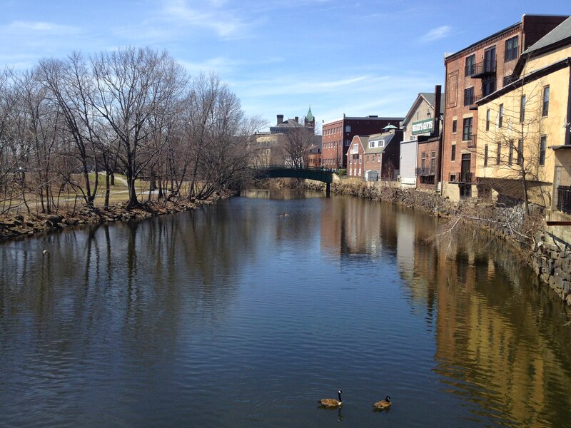
Mystic River and Alewife Brook paths
Paths along Alewife Brook and the Mystic River that link Alewife station with Medford Square and Assembly Row. People use them to ride or walk between the Minuteman Bikeway, the Red Line and the Orange Line, with river views much of the way.
- Distância
- 6.5 mi
- river path
- Piso
- Quase todo pavimentado
- Onde entrar
- 8 lugares
- no mapa
De Alewife station a Draw Seven Park
Estacionamento em 2 dos 8 lugares para entrar · Ver onde
Onde entrar
Os números correspondem à lista; P tem estacionamento.
Baixar o GPXPara Ride with GPS, Strava, Komoot ou um ciclocomputador.
Alewife station, south end of the Alewife Brook Greenway
The Minuteman Bikeway and the Fitchburg Cutoff Path meet here.
- Alewife (Red Line), about 0.2 mi.
- No parking at the reservation. DCR points drivers to the Alewife MBTA station lot.
Massachusetts Avenue crossing
Cambridge and Arlington line.
- Route 77 bus on Mass Ave, about 0.1 mi.
Broadway crossing, near Dilboy Field
Somerville side.
- Route 87 bus on Broadway. Routes 87, 88 and 89 at Clarendon Hill Busway, about 0.1 mi.
Mystic Valley Parkway, north end of the Alewife Brook Greenway
Here Alewife Brook meets the Mystic River. There is a gap in the off-road path along Route 16 between here and Medford Square.
- Routes 80, 94 and 101 bus at Boston Ave and Mystic Valley Pkwy, about 0.2 mi.
Medford Square, Clippership Connector
Paved path and boardwalk, opened in 2025, linking Medford Square to Riverbend Park.
- Routes 94, 95, 96 and 101 bus at Clippership Dr. Route 134 bus on Riverside Ave.
Torbert Macdonald Park, Medford
Wellington Underpass construction under Route 28 is next to the park. Follow detour signs.
- Wellington (Orange Line), about 0.6 mi.
Shore Drive at Blessing of the Bay Boathouse, Somerville
The path through Blessing of the Bay Park is closed until spring 2027.
- Route 95 bus on Mystic Ave at Shore Dr, about 0.2 mi.
- DCR says the Blessing of the Bay Park parking lot stays open during construction.
Draw Seven Park, Somerville
East end. The park closed for renovation in April 2025; Somerville planned to reopen it in spring 2026.
- Assembly (Orange Line), about 0.1 mi.
Como chegar
- De transporte público
- Alewife (Red Line) is at the south end. Assembly and Wellington (Orange Line) are near the east end. Buses 77 (Mass Ave), 87 (Broadway), 80 and 94 (Boston Ave) and the Medford Square buses (94, 95, 96, 101, 134) stop near the path.
- Bicicletas compartilhadas
Perto de Alewife station, agora
- Thorndike Field at Minuteman Bikewaya 3 min a pé · 7 bicicletas
- Alewife MBTA at Steel Placea 4 min a pé · 13 bicicletas
Perto de Draw Seven Park, agora
- Assembly Square Ta 3 min a pé · 15 bicicletas
- Encorea 4 min a pé · 4 bicicletas
- Estacionamento
- There is no parking at the Alewife Brook Reservation; DCR points drivers to the Alewife MBTA station lot.
MaisMenos
The Blessing of the Bay Park lot in Somerville stays open during construction.
Um Roam nesta trilha
Um Roam é uma rota autoguiada com paradas pelo caminho. O app gratuito Shift faz seu check-in em cada parada, e no fim você desbloqueia um distintivo.
A trilha inteira
Mystic River Greenway (Alewife to Medford)
Two rivers, two T stations, and 300 years of history between them
6.7 mi 41 minNo app Shift
Baixe o Shift, grátis. Siga um Roam com instruções passo a passo até cada parada e veja as interdições nas suas trilhas antes de sair.


Continue
Mystic River and Alewife Brook paths se ligam a outros caminhos e ciclovias protegidas. Escolha uma direção para ver no mapa.
Esta trilha Por onde continuar Outras ciclovias
Sobre Mystic River and Alewife Brook paths
- Piso
- Mostly paved. The Alewife Brook Greenway is part asphalt, part packed stone dust, with a wooden boardwalk near the Mystic River end. The Mystic River paths in Medford and Somerville are mostly paved, with a boardwalk on the Clippership Connector.
- Regras
- DCR lists the Alewife Brook Reservation as open sunrise to sunset and dog-friendly. DCR lists the Mystic River State Reservation as open dawn to dusk, year-round. DCR allows Class 1 e-bikes on paved DCR paths 8 feet wide or more. Class 2 and Class 3 e-bikes are allowed only where cars are allowed or in DCR bike lanes.
- Quem cuida
- Massachusetts Department of Conservation and Recreation (DCR), Alewife Brook Reservation and Mystic River State Reservation
- Também chamada
- Mystic River paths, Alewife Brook Greenway, Alewife Greenway, Mystic River Reservation paths, Mystic Greenways, Clippership Connector
Avisos
Obras e mudanças ao longo da trilha, com o desvio quando houver.
Path through Blessing of the Bay Park closed to build the Shore Drive Greenway, a new 12-foot shared-use path
Blessing of the Bay Park, Shore Drive, Somerville
The path should reopen in spring 2027, and the whole project should finish in summer 2027. There is no posted detour. The rest of the park and its parking lot stay open. During construction, bikes share the travel lane.
FonteWellington Underpass construction, a new boardwalk path under Route 28
Mystic River at Route 28 (Fellsway), Medford, near Torbert Macdonald Park and Wellington station
Expected to finish in spring 2028. Detour signs keep people on foot and bike moving along Route 28 and over the pedestrian bridge to Macdonald Park.
Fonte
Mais sobre a trilha
- Página oficial · mass.gov
- Amigos da trilha · mysticriver.org
De onde vêm estas informaçõesVerificado em 19 de out. de 2026
- traillink.com/trail/mystic-river-greenway
- boston.com/news/local-news/2012/11/04/new-path-links-alewife-mystic-areas
- mysticriver.org/greenways
- mysticriver.org/mystictominutemanpath
- mass.streetsblog.org/2025/08/07/eyes-on-the-street-medfords-new-clippership-connector
- mass.gov/locations/mystic-river-state-reservation
- mass.gov/locations/alewife-brook-reservation
- mass.gov/advisory/dcr-traffic-advisory-blessing-of-the-bay-park
- voice.somervillema.gov/shore-drive-greenway
- s3.amazonaws.com/somervillema-live/s3fs-public/2026-09/bicycle-advisory-20260702-presentation.pdf
- mass.gov/advisory/dcr-recreational-advisory-wellington-underpass-in-medford
- mass.gov/doc/update-dcr-recreational-advisory-draw-seven-park/download
- patch.com/massachusetts/somerville/somerville-state-park-parking-lot-closes-down-renovation-project
- mass.gov/doc/dcr-recreational-advisory-mystic-river-path/download
- mass.gov/e-bikes-on-dcr-property
- gbfs.bluebikes.com/gbfs/en/station_information.json
- api-v3.mbta.com/stops
- openstreetmap.org