Fort River Trail
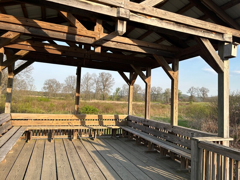
The Fort River Birding and Nature Trail is a flat loop of about one mile in a national wildlife refuge in Hadley. It is built so wheelchairs and strollers can use it, with boardwalks, benches and viewing decks for watching birds in fields, woods and wetlands along the Fort River.
- Distância
- 1.2 mi
- nature trail
- Piso
- Sem pavimento
- cascalho fino
- Onde entrar
- 1 lugar
- no mapa
Estacionamento em todos os lugares para entrar · Ver onde
Não é limpa no inverno · Quem limpa
Onde entrar
Os números correspondem à lista; P tem estacionamento.
Baixar o GPXPara Ride with GPS, Strava, Komoot ou um ciclocomputador.
Fort River trailhead, 69 Moody Bridge Road, Hadley
The only entrance. The trail is one loop that starts and ends here. A kiosk with refuge information is by the lot. Restroom near the parking area.
- PVTA Route 39 at Hartsbrook School on Bay Road, about 1.25 miles on foot by Moody Bridge Road
- Free refuge lot at the trailhead. The lot is gated at night.
Como chegar
- De transporte público
- The nearest bus is PVTA Route 39 (Smith College to Hampshire College), which stops at Hartsbrook School on Bay Road.
MaisMenos
From there it is about 1.25 miles on foot to the trailhead by Moody Bridge Road. PVTA B43 buses on Route 9 stop closer as the crow flies but have no direct road to the trail.
- Estacionamento
- Free refuge lot at 69 Moody Bridge Road.
MaisMenos
Drive in from Bay Road. Moody Bridge Road is closed to cars from the South Maple Street end. The lot can fill at busy times.
Um Roam nesta trilha
Um Roam é uma rota autoguiada com paradas pelo caminho. O app gratuito Shift faz seu check-in em cada parada, e no fim você desbloqueia um distintivo.
A trilha inteira
Fort River Trail (Silvio O. Conte Refuge)
Eight lookouts across wetlands, grasslands, and river forest, all fully accessible
0.9 mi 19 minNo app Shift
Baixe o Shift, grátis. Siga um Roam com instruções passo a passo até cada parada e veja as interdições nas suas trilhas antes de sair.


Sobre Fort River Trail
- Piso
- crushed stone, with raised wooden boardwalks over wet areas and viewing decks
- Regras
- Open year round, from a half hour before sunrise to a half hour after sunset (U.S. Fish and Wildlife Service). The trail is not cleared of snow or ice in winter (Kestrel Land Trust).
- No inverno
- Not cleared of snow or ice. Snowshoes work well when it is snowy. Fonte
- Condições de todas as trilhas
- Quem cuida
- U.S. Fish and Wildlife Service, Silvio O. Conte National Fish and Wildlife Refuge (Fort River Division)
- Também chamada
- Fort River Trail, Fort River Division, Conte Refuge Fort River, Silvio O. Conte Refuge Hadley
Avisos
Obras e mudanças ao longo da trilha, com o desvio quando houver.
Moody Bridge Road closed to through traffic from the South Maple Street end
Moody Bridge Road east of the refuge, at South Maple Street, Hadley
Drive in from Bay Road on Moody Bridge Road.
Fonte
Mais sobre a trilha
- Página oficial · fws.gov
De onde vêm estas informaçõesVerificado em 19 de out. de 2026
- fws.gov/refuge/silvio-o-conte/visit-us/trails
- fws.gov/refuge/silvio-o-conte/massachusetts-divisions-and-units
- fws.gov/sites/default/files/documents/Fort%20River%20rack%20card2_1.pdf
- kestreltrust.org/places/fort-river-trail
- pioneervalley.org/outdoors/silvio-conte-fort-river
- birdobserver.org/Issues/2025/June-2025/birding-fort-river-division-hadley-massachusetts
- hitchcockcenter.org
- pvta.com/g_trans/google_transit.zip
- openstreetmap.org/way/313287387
- openstreetmap.org/way/313287386