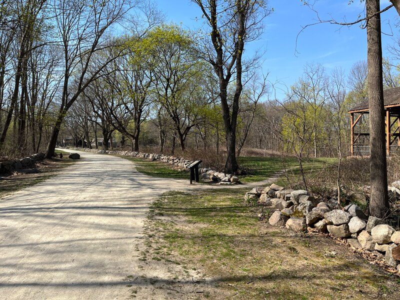
Battle Road Trail
A 5-mile unpaved path through Minute Man National Historical Park that follows the road of the first battle of the American Revolution. People walk and ride it for the fields, woods and old farmhouses, and to see where the fighting of April 19, 1775 took place.
- Distancia
- 5 mi
- nature trail
- Superficie
- Sin pavimentar
- Dónde entrar
- 4 lugares
- en el mapa
De Meriam's Corner lot a Fiske Hill / Wood Street lot
Estacionamiento en cada lugar para entrar · Ver dónde
No se limpia en invierno · Quién lo limpia
Abierto. Sin cierres al 2 nov 2026.
Dónde entrar
Los números corresponden a la lista; P tiene estacionamiento.
Descargar el GPXPara Ride with GPS, Strava, Komoot o un ciclocomputador.
Meriam's Corner lot, Lexington Road, Concord
West end of the trail.
- NPS parking lot on Lexington Road. Gate closes at sunset.
Hartwell Tavern lot, North Great Road (Route 2A), Lincoln
Hartwell Tavern is open Thursday, Saturday and Sunday 10 am to 4:30 pm, June through October.
- Large NPS lot (Hartwell historic area). Gate closes at sunset.
Minute Man Visitor Center, 210 North Great Road, Lincoln
Restrooms. Open daily 9 am to 5 pm through Oct 31, 2026. Bike racks.
- MBTA bus 76 stops on Wood Street near MIT Lincoln Laboratory, a short walk away
- Visitor center lot. Gate closes at sunset.
Fiske Hill / Wood Street lot, Lexington
East end of the trail, at the park's eastern edge.
- MBTA bus 76 stops on Marrett Road near Forbes Road, about a quarter mile away
- Small NPS lot off Wood Street.
Cómo llegar
- En transporte público
- MBTA bus 76 (Alewife to Lincoln Lab) stops on Marrett Road and Wood Street near the east end and the Minute Man Visitor Center.
MásMenos
Concord commuter rail station (Fitchburg Line) is about 2 miles west of Meriam's Corner.
- Estacionamiento
- Several free NPS lots along Route 2A (North Great Road) and Lexington Road, including Meriam's Corner, Hartwell Tavern, the Minute Man Visitor Center and Fiske Hill.
MásMenos
Lot gates close at sunset.
Un Roam en este sendero
Un Roam es una ruta autoguiada con paradas en el camino. La app gratuita Shift registra tu llegada a cada parada y al final desbloqueas una insignia.
Todo el sendero
Battle Road Trail
Walk the path of the American Revolution, from Lexington to Concord
6 mi 2 hEn la app Shift
Descarga Shift, gratis. Sigue un Roam con indicaciones paso a paso a cada parada y mira los cierres de tus senderos antes de salir.


Sigue adelante
Battle Road Trail conecta con otros caminos y carriles bici protegidos. Elige una dirección para verla en el mapa.
Este sendero Por dónde seguir Otras ciclovías
Sobre Battle Road Trail
- Superficie
- Packed sand and clay (unpaved), with some boardwalks. Some parts get soft after rain.
- Normas
- Park grounds open sunrise to sunset; lot gates close at sunset. Bikes are welcome but must walk on boardwalks and stay off fields and lawns. E-bikes are allowed where bikes are, if they have working pedals and a motor under 750 watts; riders must pedal, keep to 10 mph and yield to walkers. Dogs must be on a leash no longer than 6 feet; carry out dog waste, there are no trash cans. Open all year; NPS suggests cross-country skiing and snowshoeing in winter.
- En invierno
- Open for skiing and snowshoeing in winter. The park can close it for snow and ice, and does not say it plows. Fuente
- Estado de todos los senderos
- Baños
- Minute Man Visitor Center (open daily through Oct 31, 2026). The North Bridge Visitor Center in Concord also has restrooms but is off the trail.
- Quién lo mantiene
- National Park Service (Minute Man National Historical Park)
- También llamado
- Battle Road, Minute Man Park trail, Minute Man National Historical Park trail
Más sobre el sendero
- Página oficial · nps.gov
- Amigos del sendero · friendsofminuteman.org
De dónde vienen estos datosRevisado el 19 oct 2026
- nps.gov/thingstodo/bike-the-battle-road-trail.htm
- nps.gov/thingstodo/hike-the-battle-road-trail.htm
- nps.gov/mima/planyourvisit/conditions.htm
- nps.gov/mima/planyourvisit/hours.htm
- nps.gov/mima/mima-gaoa.htm
- developer.nps.gov/api/v1/alerts
- developer.nps.gov/api/v1/visitorcenters
- developer.nps.gov/api/v1/parkinglots
- friendsofminuteman.org
- api-v3.mbta.com/stops
- gbfs.bluebikes.com/gbfs/en/station_information.json
- openstreetmap.org/relation/4009025